Part of Germany
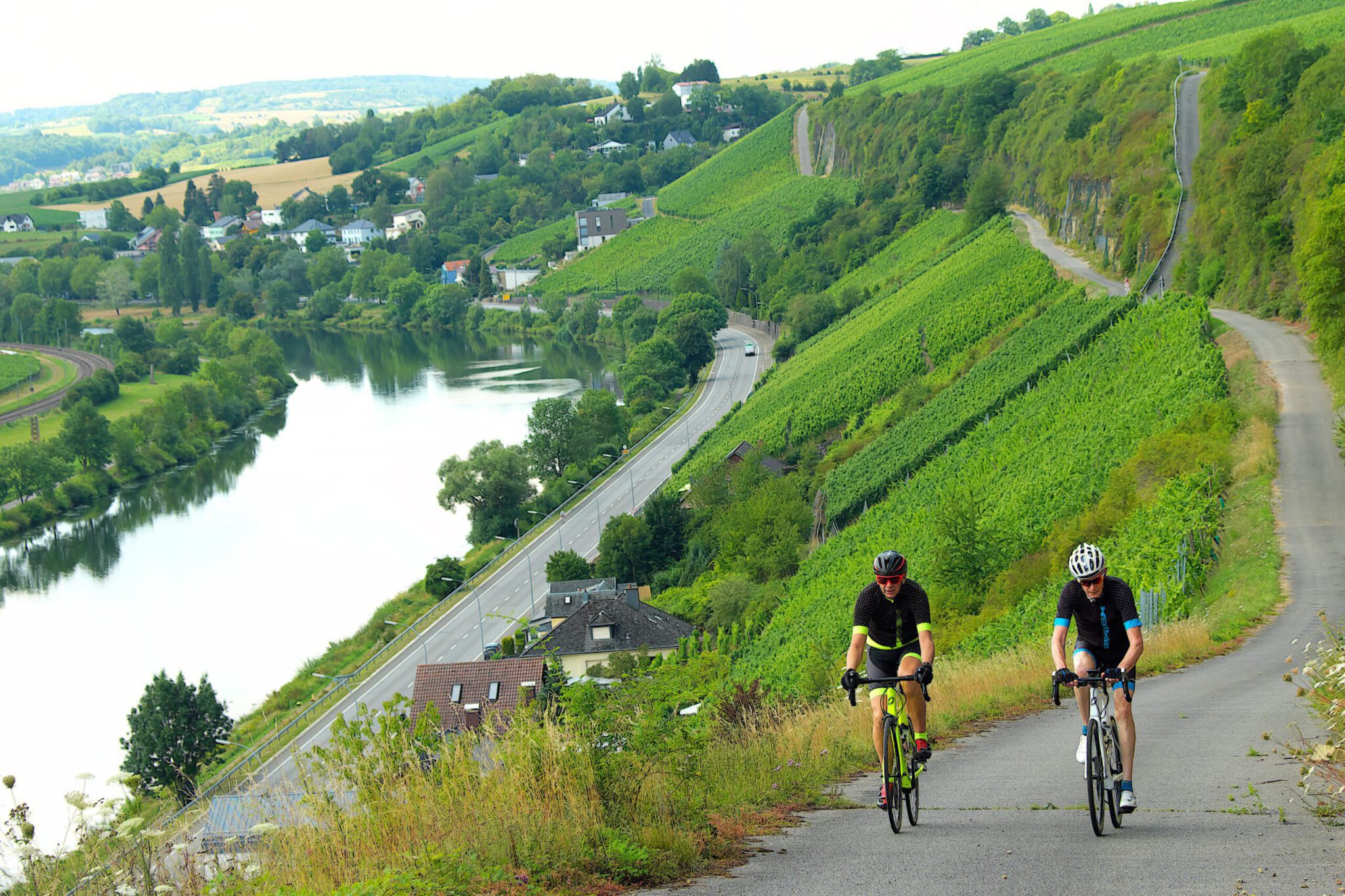
Rhineland-Palatinate is the part of the river valleys and the central mountains, and for cyclists it is one of the most underrated parts of Germany. In one state you find the Eifel with the Nürburgring, the Moselle with its steep wine slopes, the Hunsrück, the Nahe, the Middle Rhine with its castles, and all the way in the south the Pfälzerwald. The pattern is the same everywhere: you drive along the river, climb through the vineyards to a plateau, drive there on quiet roads through forests and fields, and dive into the next valley again. After the ride, there is a glass of riesling waiting. And from the middle of the Netherlands you are there in three to five hours.
Why cycle in Rhineland-Palatinate?
- Close by. The Eifel and the Moselle can be reached in three to four hours by car, the Pfalz in about five. Ideal for a long weekend.
- Climbing without the Alps. Climbing from five to ten kilometers, from river to high plateau. In a day of 100 kilometers, you can cover 1,500 meters of elevation gain.
- Quiet roads. On the high plateaus of the Hunsrück and the Eifel you sometimes won't see a car for a quarter of an hour.
- Cycling routes from the tourist offices. Rheinland-Pfalz Tourismus has created dozens of cycling routes with GPX and descriptions. We chose six of them.
- Wine and food. The Moselle, the Nahe, the Ahr, the Middle Rhine and the Pfalz are all wine regions. You’ll find taverns and wine producers with a terrace in every village.
The areas
Eifel. Volcanic plateau with marshes (crater lakes), the Hohe Acht (747 meters, the highest point of the Eifel) and the Nürburgring. Around the Ring, the Radarena am Ring has laid out more than 1,500 kilometers of bike trails. Steeply undulating, with little traffic.
Moselle. The classic river valley between Trier and Koblenz, with the steepest vineyards in Europe. Along the river the terrain is flat; every side road up to the vineyards is a climb. Cochem, Zell and Bernkastel-Kues are nice starting points.
Hunsrück. The plateau between the Moselle, Rhine and Nahe rivers. Here stands the Erbeskopf, with 816 meters the highest point of Rhineland-Palatinate, and the Geierlay suspension bridge near Mörsdorf. The Soonwald on the south side has winding forest paths that are very popular with cyclists.
Close. Sunny wine region around Bad Kreuznach, with rock walls along the river and the Naheweinstraße through the wine villages. Sloping, warm and somewhat friendlier than the Hunsrück.
Middle Rhine. The UNESCO World Heritage Sites between Bingen and Koblenz: castles, the Loreley and steep walls. There are no bridges between Bingen and Koblenz, so you cross over by ferry. The climbs from the valley to the high plains are short and steep.
Pfalz. Right in the south: the Deutsche Weinstraße on the edge of the Rhine plain and behind it the Pfälzerwald, one of the largest contiguous forests in Germany. The Kalmit (673 meters) is the highest point of the Pfälzerwald and the most famous climb in the region, from Maikammer. The climate is mild: almond trees and figs grow here even.
Six bicycle routes
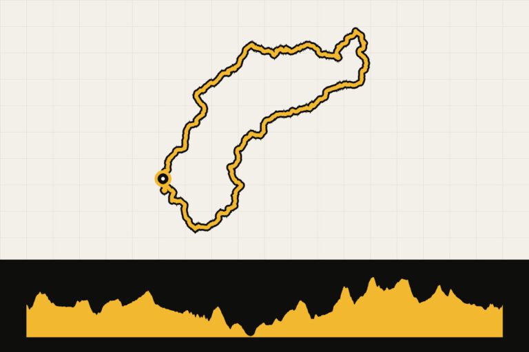
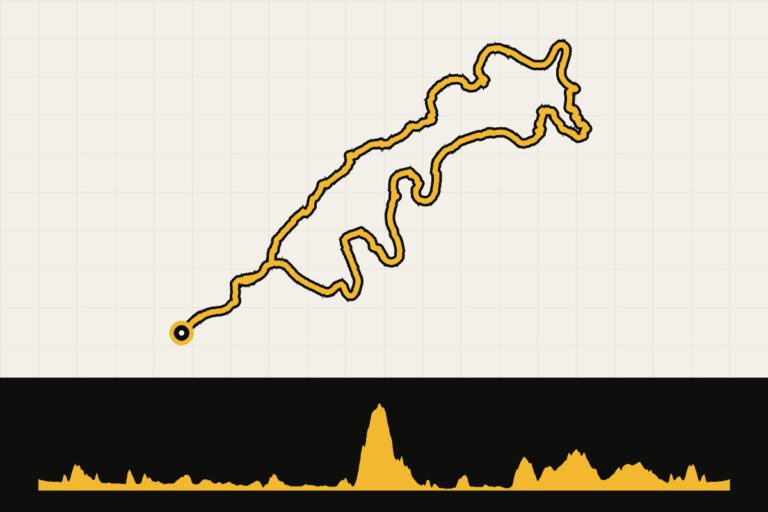
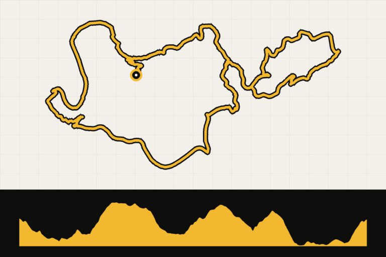
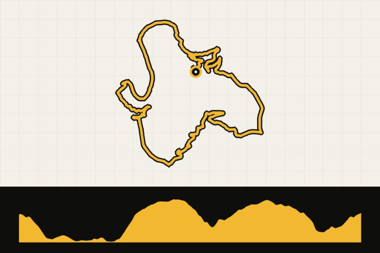
These routes come from the tourist bureaus of Rhineland-Palatinate and are made for the mountain bike. As soon as the GPX files are available with us, you will find them with map and elevation profile in the route overview below.
- Erbeskopf Climb (Hunsrück), 116 km, 1,800 m elevation gain. The Queen's Ride: to the highest point of Rhineland-Palatinate, over the quiet roads of the Hunsrück.
- Tour de Heimat through the Soonwald, 69 km, 1,166 hm. Dense forests, castle ruins and hairpin bends. Short but tough, with beautiful descents.
- Zeller Panorama Tour, 50 km, 500 hm. From the Hunsrück to the Moselle near Zell: the ideal introduction, with a view over the wine valleys.
- Romantic World Heritage Site Middle Rhine, 66 km, 901 hm. Along the castles of the Rhine Valley and up to the high plateaus, with the ferry stop as a stopover.
- On narrow tires over the Naheweinstraße, 101 km, 921 m altitude. A long, undulating day through the wine villages of the Nahe.
- King's stage in the Palatinate, 136 km, 2,117 hm. From Hochspeyer through the Pfälzerwald to the Weinstraße, with seven steep climbs and as a dessert the Kalmit.
Climbing to remember
- Kalmit (Pfalz). From Maikammer, about six kilometers up through vineyards and forest to the top at 673 meters, overlooking the Rhine Valley.
- Erbeskopf (Hunsrück). No steep wall, just a long, gradual climb to the roof of the state.
- High Acht (Eifel). The highest point of the Eifel, near the Nürburgring.
- Roads along the Moselle and Middle Rhine. Short and steep, often with hairpin bends between the vines. Each climb ends with a view of the river.
Your Cycling base
- Cochem or Zell (Moselle) for the Moselle, Eifel and Hunsrück in one week.
- Bad Kreuznach (Nahe) for the Nahe, the Soonwald and the Middle Rhine.
- Boppard or Bacharach (Middle Rhine) for castles, steep climbs and the ferry bridge.
- Neustadt an der Weinstraße of Maikammer (Pfalz) for the Kalmit, the Pfälzerwald and the Weinstraße.
An example week (Meuse and Hunsrück)
- Day 1: Arrive in Zell and take the Zeller Panorama Tour.
- Day 2: The Erbeskopf Climb, the longest day of the week.
- Day 3: rest day: wine tasting on the Moselle or a walk through the Geierlay.
- Day 4: to the Nahe and the Tour de Heimat through the Soonwald.
- Day 5: the World Heritage Site of the Middle Rhine, with the ferry and the walks along the Loreley.
- Day 6: a peaceful ride along the Moselle, or another climb up the vineyards.
If you want to visit the Pfalz, plan a second weekend: the Pfalz is about two hours’ drive south and is a destination in itself.
Tips
- Climbing from the water. Almost every ride starts in a valley. Drive the first few kilometers slowly; the first climb comes quickly.
- Weekend. Along the Moselle and Middle Rhine rivers, it gets busy with motorcycles and tourists on beautiful weekends. Choose the high plateaus or leave early.
- Ferry crossings. Between Bingen and Koblenz, you cross the Rhine by ferry. The ferries run all day, but check the last departure if you’re returning in the evening.
- Brakes. The descents through the vineyards are steep and winding, with sometimes gravel or leaves on the road. Take them slowly.
When are you leaving?
May, June and September are ideal: not too hot and the vineyards at their best. In July and August it can be hot in the valleys; in October it is harvest time.
From April to October. In the wine regions it is often a few degrees warmer than in the high plateaus, and the Pfalz is the warmest corner of Germany. September and October are especially beautiful: it is harvest time and the vineyards turn yellow and red.
How do you get there?
By car you can be in the Eifel or on the Moselle in three to four hours, and in the Pfalz in about five hours. By train you can travel to Koblenz, Trier, Cochem, Bad Kreuznach or Neustadt an der Weinstraße; on regional trains you can usually bring your bike along.
Sources
- Rheinland-Pfalz Tourismus – official race bike routes (via outdooractive)
This is how we calculate: We calculate distances and travel times starting from Utrecht. Our flights always depart from Schiphol, Rotterdam The Hague Airport or Eindhoven Airport. Want to know how to travel from your place of residence the best way? Let us know, We are happy to help you. After all, we built this site together.
Are you flying? Read our guide Flying with your bike: Which airline, what the cost is and how to pack your bike.