In the far west of Belgium, opposite the French border, lie the hills of Heuvelland and the flat polders of the Westhoek. This is the territory of Gent-Wevelgem, with the notorious Kemmelberg, and of the memory of the First World War: around Ypres there are hundreds of military cemeteries, craters and monuments.
Cycling here is a mix of sport and history. You climb over short, steep hills with cobblestones, ride on quiet polder roads with the wind as your opponent, and stop at places that make you stop in your tracks along the way. And after the ride, you can enjoy a Trappist beer from Westvleteren or a beer in Poperinge.
Why cycle in the Heuvelland and the Westhoek?
- The KemmelbergWith 156 meters, it is the highest point in West Flanders, with gravel and sections of more than twenty percent. The highlight of Gent-Wevelgem.
- More hillsThe Monteberg, the Redberg, the Black Mountain and the Scherpenberg are located close to each other, also across the border in France.
- The PlugstreetsUnpaved sections near Ploegsteert, a fixture of Gent-Wevelgem for a few years now and perfect for the gravity bike.
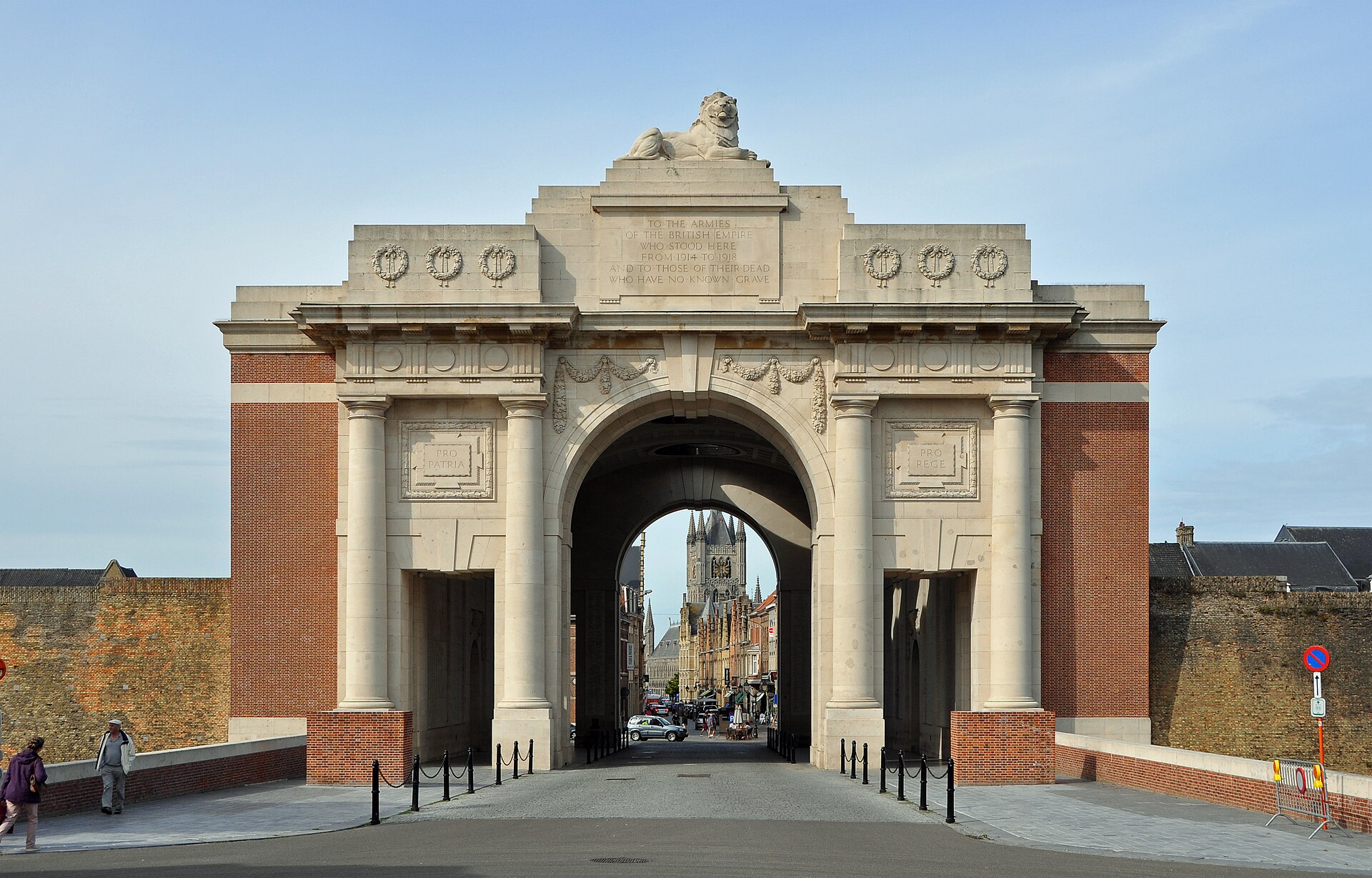
- History: The Menen Gate in Ypres, the Pool of Peace at the Spanbroek Mill, Tyne Cot and the monument to the Christmas congregation at Ploegsteert.
Race bike: the hills of Gent-Wevelgem
The classic route follows the course of Gent-Wevelgem: start in Ypres, via the Plugstreets to the hills around Kemmel and then up the Kemmelberg, preferably from the steep side along the French necropolis (Ossuaire). The Monteberg and the Baneberg are right next to it, and those who want to go further cross the border to the Mont Noir and the Mont des Cats in Frans-Wallonia.
Cycling and gravel in the Westhoek
North of Ypres the terrain becomes flatter. Along the IJzer, around Diksmuide and towards the coast you drive along quiet polder roads and hunting trails. With the gravelfiets you combine the Plugstreets with church paths and country roads; the slopes of the Heuvelland are also well passable with wide tires.
Three rides to get you started
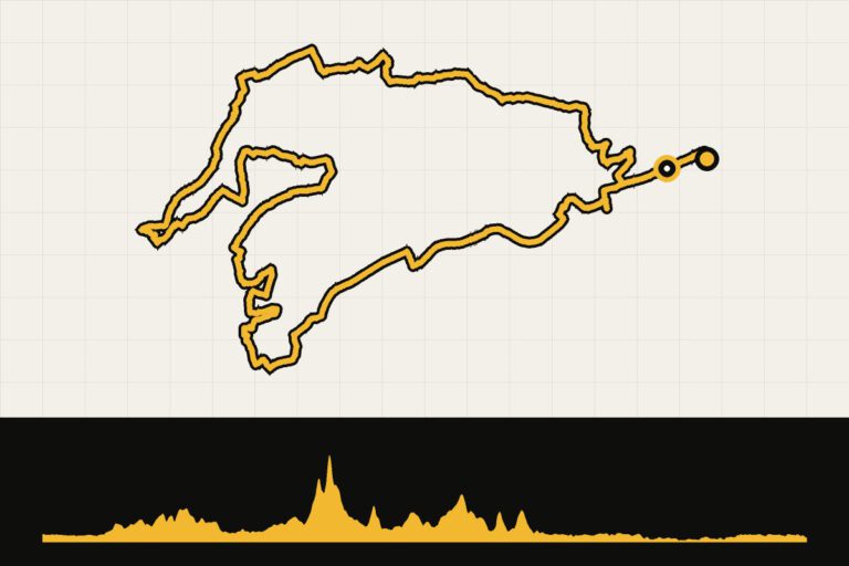
- Ghent-Wevelgem: In Flanders Fields84 kilometers along the Plugstreets, the Kemmelberg and the most important places from the war, with start and finish in Kemmel.
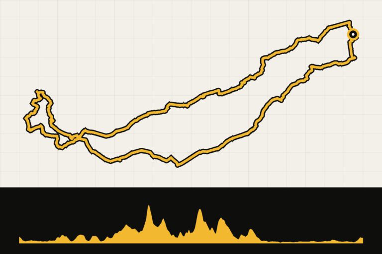
- Gent-Wevelgem 2023: a longer version of the classic’s course, over 114 kilometers.
- Monte Marcella: Gent-Wevelgem: a ride from the bike accommodation at Monte Marcella.
All GPX routes are listed at the bottom of this page. Also read our stories In Flanders Fields: an ode to the First World War and Cycling in Flanders Fields, and about Monte Marcella.
When are you leaving?
From March to October. At the end of March, Gent-Wevelgem is raced; around that day it is busy on the Kemmelberg, but the atmosphere is great. In the summer, things are quieter on the roads. Every evening at eight o'clock there is the Last Post under the Menen Gate in Ypres: an impressive end to a ride.
How do you get there?
By car, you can get to Ypres in about three hours from Utrecht. By train, you can travel via Kortrijk or Ghent to Ypres or Poperinge; you can also use a bicycle.
This is how we calculate: We calculate distances and travel times starting from Utrecht. Our flights always depart from Schiphol, Rotterdam The Hague Airport or Eindhoven Airport. Want to know how to travel from your place of residence the best way? Let us know, We are happy to help you. After all, we built this site together.
Are you flying? Read our guide Flying with your bike: Which airline, what the cost is and how to pack your bike.
Where to stay?
Ieper is the most convenient base, with many hotels and restaurants and the Menenpoort right around the corner. In Kemmel and Westouter you are right in the middle of the hills, and Poperinge is a cozy town between the hop fields.
See places to stay in: Ieper · Kemmel · Westouter · Poperinge
Who is Heuvelland and the Westhoek for?
For cyclists who want to feel the classics, and for anyone who wants to combine history and sport. The hills are short, so it's easy for those who aren't climbers, but the gravel roads and the wind never make it easy.