Part of France
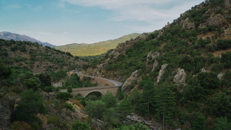
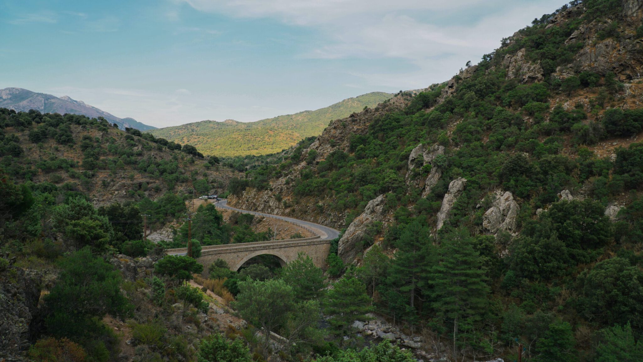
Corsica is also called a mountain in the sea. The island is rugged and mountainous, with peaks of more than 2,500 meters at just 50 kilometers from the coast. For cyclists, that means almost no flat meters, endless hairpin bends, coastal roads along red rocks, and quiet mountain villages where time has stopped. In 2013, the Tour de France began here, and anyone who has driven the roads understands why.
Why cycle in Corsica?
- Variety. In one day you drive from the sea to a new place at 1,400 meters and back to the beach.
- Coastal roads. The road around Cap Corse and along the Calanques of Piana are among the most beautiful coastal routes in Europe.
- Silent mountains. In the interior you will encounter more cows, pigs and goats than cars.
- Food. Brocciu, figatellu, chestnut bread and a glass of Patrimonio: the Corsican cuisine is a reason in itself.
- A crossing. With the GT20 you can travel from Bastia to Bonifacio in a week, crossing the mountains.
The areas
Cap Corse. The rugged northern tip of the island, north of Bastia. The road around the cape winds past cliffs, Genoese towers and small harbors. It is heavily traveled due to the many short climbs.
The Balagne. Between L’Île-Rousse and Calvi are the mountain villages of the Balagne, such as Speloncato and Sant’Antonino, perched on their mountaintops above the sea. A region of olive trees and crafts.
The west coast. From Galéria via Porto to Piana runs one of the most spectacular roads in France, along the red rocks of the Calanques. In Porto begins the climb to Évisa, through the forest of Aïtone.
The interior. Corte is the heart of Corsica, the ancient capital in the mountains. From here you can climb over the Col de Vergio, the highest paved pass on the island at 1,477 meters, or through the Restonica Valley.
The South The Alta Rocca, around Zonza and Levie, with the Col de Bavella and its granite needles. At the bottom are Porto-Vecchio and Bonifacio, the white city on the cliffs.
You must not miss these climbs
- Col de Vergio. The highest pass of the island, from Porto or from Corte through the Niolo.
- Col de Bavella. A climb through the forest to the granite needles of Bavella, with views to the sea.
- Col de Vizzavona. The old road between Ajaccio and Bastia, through dense beech and pine forests.
- Climb to Évisa. From Porto along the Spelunca gorge to the mountain village of Évisa.
Crossing Corsica: the GT20 in seven days
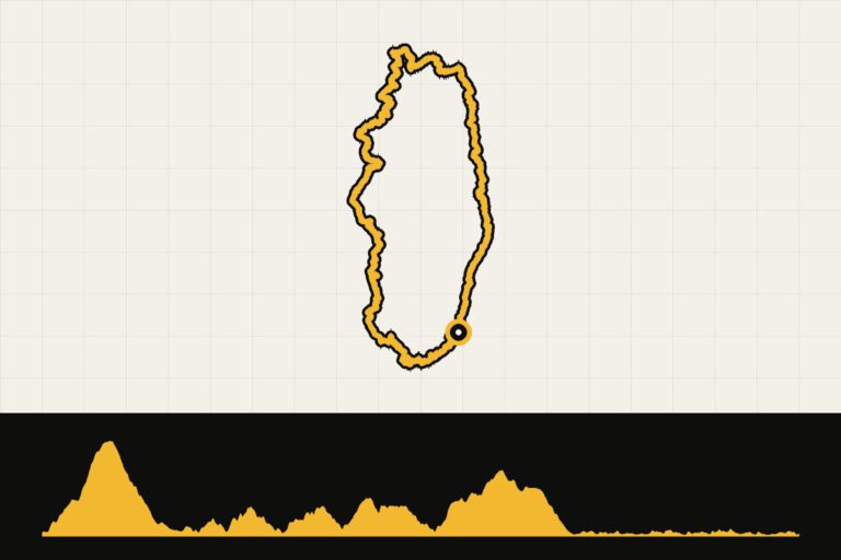
The GT20 is the bicycle version of the famous GR20: a journey of over 600 kilometers from Bastia to Bonifacio, over the mountains of the island. We rode it in seven days, covering about 90 kilometers.
Multi-day adventure · Race bike
Corsica: the GT20 in seven days
- 7days
- 605km
- 11.877altimeters
- 86km per day
- 1
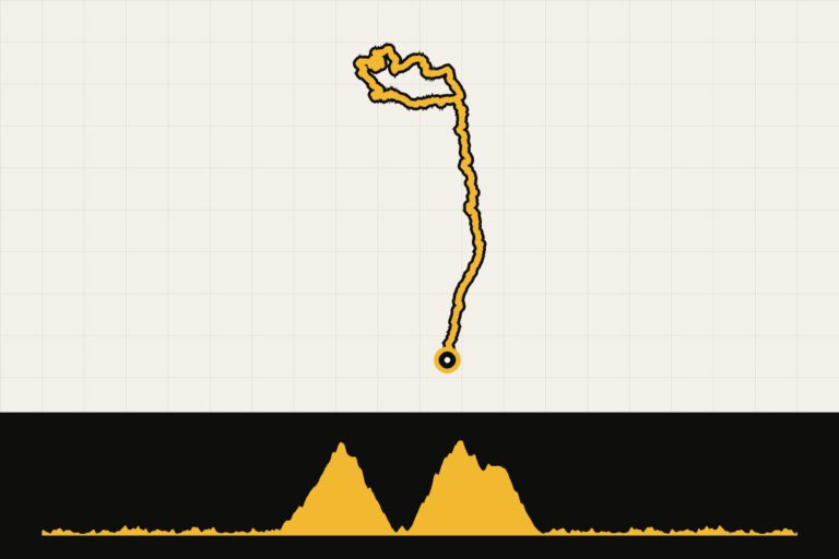
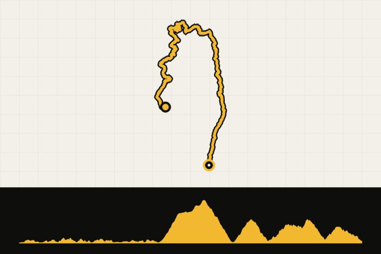 Day 1 · 88.8 km · 1,630 hmCorsica GT20 Day 1: Bastia to OgliastroAround Cap Corse, the rugged northern tip.Map, profile & GPX from day 1 →
- 2
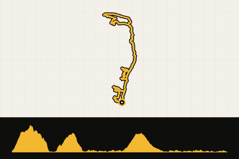
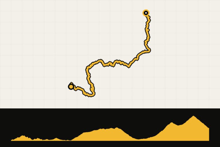 Day 2 · 85.5 km · 1,692 hmCorsica GT20 day 2: From Ogliastro to BelgodèreThrough the Nebbio to Belgodère.Map, profile & GPX of day 2 →
- 3
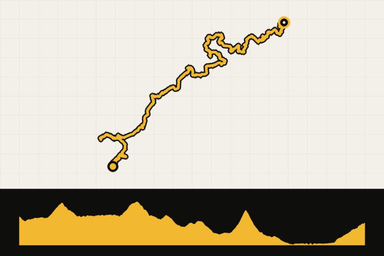 Day 3 · 89.9 km · 1,489 hmCorsica GT20 day 3: Belgodère to GalériaFrom the villages of the Balagne to Galéria.Map, profile & GPX of day 3 →
- 4
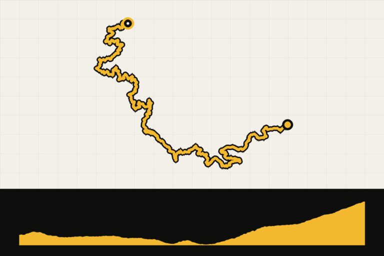 Day 4 · 69.7 km · 2,106 hmCorsica GT20 day 4: Gallery to ÉvisaAlong the Porto Bay and the climb to Évisa.Map, profile & GPX of day 4 →
- 5
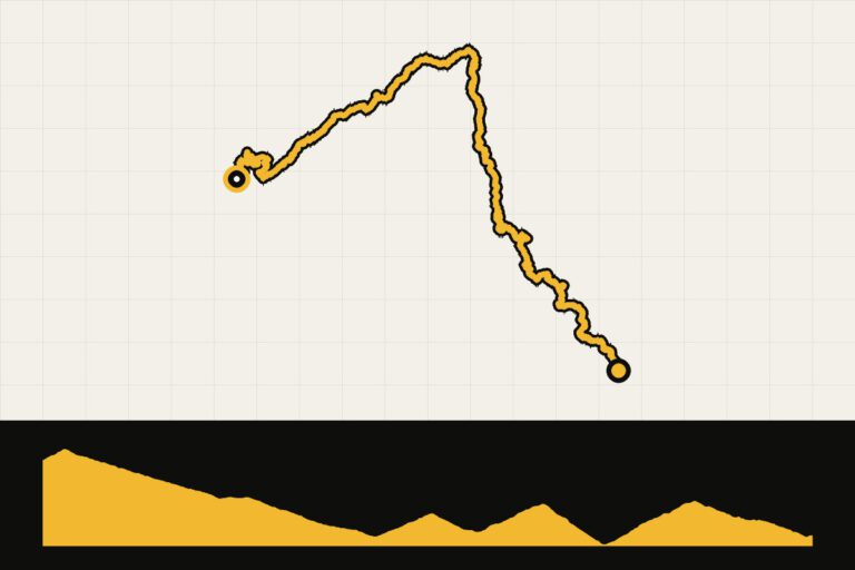 Day 5 · 95.8 km · 1,578 mCorsica GT20 day 5: Évisa to PietrosoOver the Col de Vergio to Corte.Map, profile & GPX of day 5 →
- 6
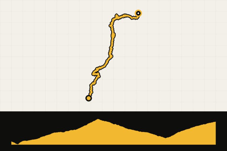 Day 6 · 73.2 km · 2,004 hmCorsica GT20 day 6: Pietroso to ZicavoOver the Col de Verde through the forests.Map, profile & GPX of day 6 →
- 7
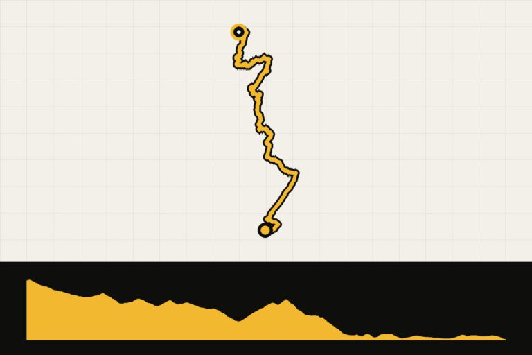 Day 7 · 102.1 km · 1,378 hmCorsica GT20 day 7: to Porto-Vecchio and BonifacioVia the Alta Rocca to Bonifacio.Map, profile & GPX of day 7 →
The GT20: Crossing Corsica
The GT20 is the bicycle version of the GR20, the famous and difficult hiking route over the mountain pass of the island. The cycling route runs from Bastia to Bonifacio and takes you through almost everything Corsica has to offer in a week: Cap Corse, the villages of the Balagne, the Porto Bay, the Col de Vergio, the inland around Corte and the Alta Rocca. With stages of about 90 kilometers and 1,500 to 2,000 meters of elevation gain per day, it is a tough journey. You can ride it with luggage on the bike, or with a luggage service that brings your belongings to the next hotel.
The Tour de France in Corsica
In 2013, the hundredth Tour de France began in Corsica, with three stages over the island: from Porto-Vecchio to Bastia, from Bastia to Ajaccio and from Ajaccio to Calvi. It was the first time the Tour visited the island. Many of those roads, such as the coastal route along the Calanques, are still favorites with cyclists.
Food and drink
The Corsican cuisine is hearty and honest. Try figatellu (a dried liver sausage), brocciu (a soft goat cheese), wild boar stew and chestnut pie. At lunch in a mountain village you often get a simple menu of the day. A glass of wine from Patrimonio or Pietra, the island’s chestnut beer, completes the day.
Your Cycling base
If you don't want to cover the entire island, choose a fixed base. Calvi of L’Île-Rousse for the Balagne and the west coast, Corte for the mountains in the interior, Porto-Vecchio for the Alta Rocca and Bavella. Porto It is small, but is located right between the coastal road and the climb to Évisa.
Grand Traverse of Corsica
Of GT20 (592 km, Bastia – Bonifacio) is the signposted cycling route that runs across the island, along the coast and through the mountains.
When are you leaving?
April, May and June are the most beautiful months: green, blooming and still calm. September and October are also fine, with warm seawater. In July and August it is hot and busy, especially on the coastal roads and around the ports. In spring it can still be cool in the mountains and sometimes there is snow on the highest passes.
Practical
- The roads are narrow and the descents are technically challenging. Drive calmly and keep an eye out for straying livestock behind every bend.
- Bring enough food and water with youIn the interior, the villages are far apart and not everything is open.
- A compact gearbox It’s not an unnecessary luxury: the climbs are long and sometimes steep.
Keep in mind that Corsicans drive very aggressively and that the roads often have no kerb. In the summer, campers and rental cars drive on the coastal roads; therefore, start early. In the spring and autumn, you have the roads to yourself for the most part.
How do you get there?
Corsica has airports in Bastia, Ajaccio, Calvi and Figari. During the season there are direct flights from the Netherlands; otherwise you fly via Nice, Marseille or Paris. By car you drive to Nice, Toulon or Marseille, or to Savona or Livorno in Italy, and take the ferry to Bastia, Calvi, L’Île-Rousse or Ajaccio.
Sources
- France Vélo Tourisme: cycling routes – long-distance routes
- Destinations France by Bike 2026 – award-winning cycling regions
This is how we calculate: We calculate distances and travel times starting from Utrecht. Our flights always depart from Schiphol, Rotterdam The Hague Airport or Eindhoven Airport. Want to know how to travel from your place of residence the best way? Let us know, We are happy to help you. After all, we built this site together.
Are you flying? Read our guide Flying with your bike: Which airline, what the cost is and how to pack your bike.