Part of France
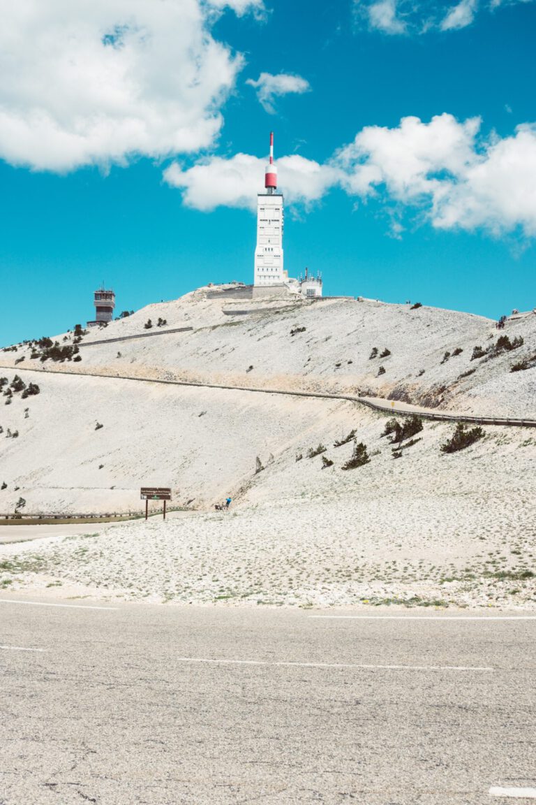
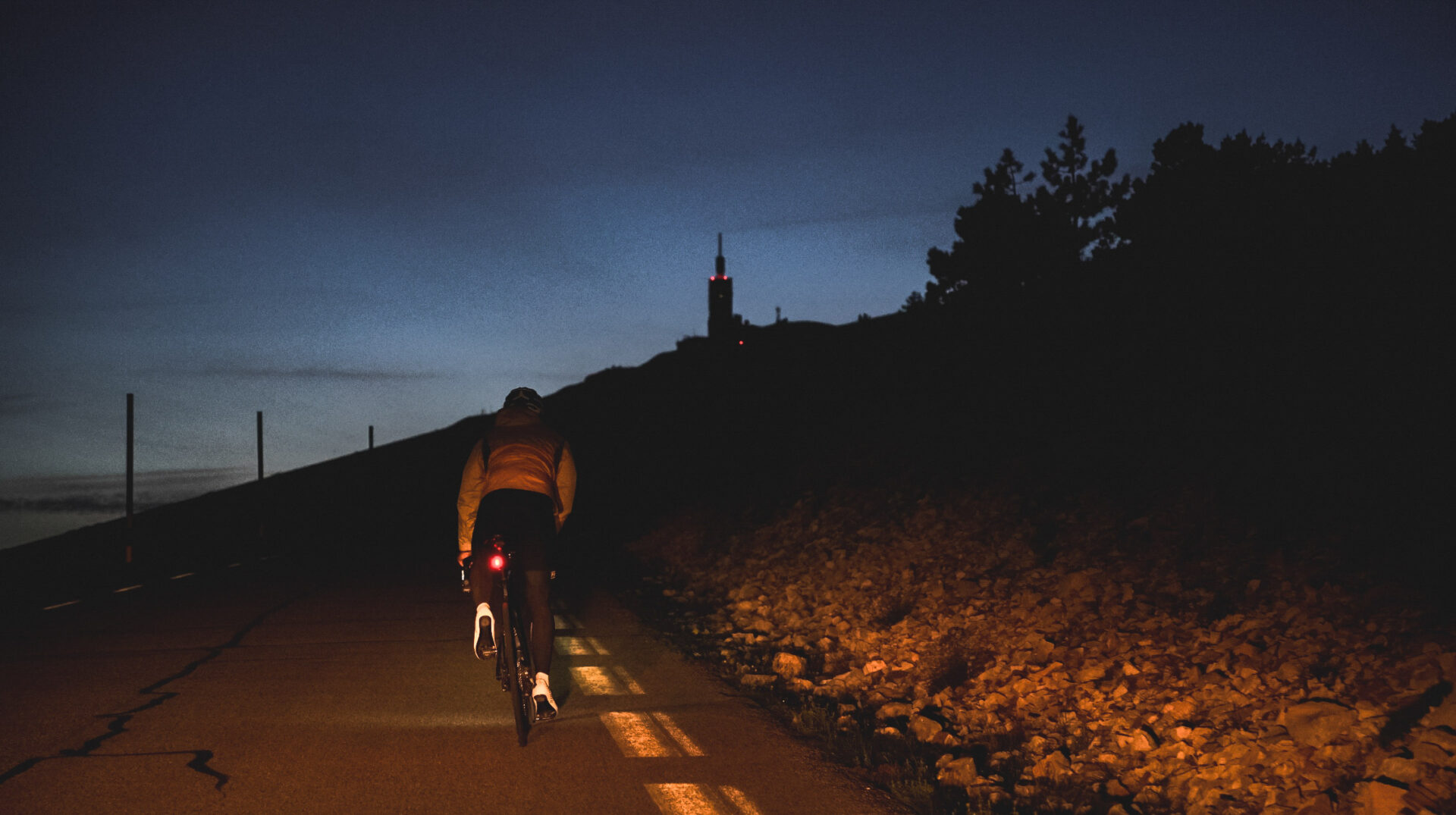
The Mont Ventoux is the giant of Provence. With its peak at 1,912 meters, it stands out far above the vineyards and lavender fields of southern France, and you can see it from tens of kilometers away: a bare, white peak with the weather station tower on it. Three roads lead up, all of them steep, and each has its own character. For many cyclists, it is the mountain where it all began. For everyone else, it is a mountain that you must have conquered once.
Why the Mont Ventoux?
- Tourlegendary. The Tour de France often finished here, and the stories are numerous: from Tom Simpson in 1967 to the struggling Chris Froome in 2016.
- Three faces. Bédoin, Malaucène and Sault are three very different climbs. Anyone who rides all three on a single day becomes a member of the Cinglés du Mont Ventoux.
- The lunar landscape. Above the tree line you drive over bare limestone, with the black-and-yellow poles along the road and the tower in sight. Nowhere does a summit feel so unreal.
- The Provence area around it. Quiet roads through vineyards, villages perched on hills, markets, and rosé on the terrace after the ride.
The three climbs
The figures below come from rides.bike.
Bédoin: the classic
21.5 kilometers with 1,612 meters of elevation gain, an average of 7.5 percent. This is the side of the Tour and the side that most people mean when they say ‘the Ventoux’. In Bédoin there is a line on the street where the segment starts. The first 5.5 kilometers through the vineyards are easy, but don’t start too fast: in Saint-Estève the road turns left into the forest and a new climb seems to begin. For kilometers it goes at 9 to 10 percent, with few curves, so you can look far ahead. At Chalet Reynard you come out of the forest and into the lunar landscape. At 1.4 kilometers before the top there is the monument to Tom Simpson. Read the Classic Ride by the Mountain High Chasers.
Malaucène: the expert
21.2 kilometers with 1,535 meters of elevation gain, an average of 7.2 percent. The north side starts sharply, with kilometers of 10 to 12 percent, and is quieter than Bédoin. For Jeffrey Wiese, who climbed the mountain four times in one day, this is his favorite side. The descent to Malaucène is also the most beautiful way to complete a round: from Malaucène you can drive back to Bédoin in no time.
Sault: the connoisseur
25.9 kilometers with 1,220 meters of elevation gain, an average of 4.7 percent. The longest and easiest stretch, through the lavender fields of the plateau of Sault, is at its most beautiful in June and July when the lavender blooms. It rarely goes steeper than 7 percent until you reach the Chalet Reynard de Bédoin route for the final six kilometers through the lunar landscape. A nice first introduction: Jeffrey rode his first Ventoux as a 17-year-old from Sault.
The Cinglés of Mont Ventoux
Since 1988, the Cinglés club has existed; the ‘crazy’ people of the Ventoux. You become a member by climbing all three sides in one day, covering a total of about 137 kilometers with 4,400 meters of elevation gain, and proving it with stamps on a stamp card. You get these stamps from cafés in the three villages. Jeffrey took it a step further and also climbed the unpaved climb from Bédoin, with almost 14 kilometers of gravel and loose rocks. Read his story about 4 times the Ventoux.
Around the Ventoux
Make your trip more than just one climb. On the west side lie the jagged limestone cliffs of the Dentelles de Montmirail, with tranquil paths between the wine villages of Gigondas and Beaumes-de-Venise. From Sault, you dive into the Gorges de la Nesque, a gorge with tunnels and viewpoints. And Vaison-la-Romaine, with its Roman ruins and Tuesday market, is a lovely place to stay or have lunch.
What should you pay attention to?
- Wind. The name says it all: the Mistral can blow at speeds of over 90 kilometers per hour at the summit. Check the wind forecast for the summit in advance and postpone your ride in case of strong winds.
- Temperature. A difference of 20 degrees between low and high altitude is normal. Always bring a windbreaker or rain jacket, even in July. The Mountain High Chasers set off at 23 degrees and saw snow above.
- Food and drink. Chalet Reynard, near the tree line, is the only reliable place on the mountain for water and food. Fill your water bottles in the village.
- Lockdown. The upper part of the road is closed in the winter, from about mid-November to mid-April.
Tour du Ventoux and Destination France by Bike
Around the mountain runs the Tour du Ventoux (128 km, a circuit from Vaison-la-Romaine): a signposted circuit over the flanks, without reaching the summit. The region around the Ventoux was awarded the title of Destination France à Vélo in 2026.
When are you leaving?
June, September and October are ideal. In July and August it is hot and busy: start very early. The peak season is from about mid-November to mid-April.
June, September and October are ideal: the road is open, the temperature is good and there is less traffic. May and early November can also be good, but then it can be very hot in the valley. In July and August it is very hot in the valley and there is a lot of traffic on the mountain; start very early then. In winter the summit is closed.
Overnight stay
The most popular starting point is Bédoin, with the Hotel La Garance as a well-known bike hotel: closed parking, a workshop and a early breakfast. In Malaucène, Hotel Le Ventoux is a simple, bike-friendly option, far from the hustle and bustle of Bédoin. If you want more luxury, Château Talaud near Carpentras is a Provençal castle hotel with a swimming pool, and for groups, Domaine les Grands Devers near Vaison-la-Romaine is available for rent. Carpentras, 15 kilometers from Bédoin, has the most hotels and restaurants.
How do you get there?
- Car: From Utrecht it’s about 1,000 kilometers to Bédoin, via Luxembourg and Lyon. Expect ten to eleven hours of driving. A car is handy: the three start villages are small and public transport is limited.
- Aircraft: Fly to Marseille (about an hour and a half drive) and rent a car there.
- Train: by TGV via Paris to Avignon, and then continue with a rental car.
This is how we calculate: We calculate distances and travel times starting from Utrecht. Our flights always depart from Schiphol, Rotterdam The Hague Airport or Eindhoven Airport. Want to know how to travel from your place of residence the best way? Let us know, We are happy to help you. After all, we built this site together.
Are you flying? Read our guide Flying with your bike: Which airline, what the cost is and how to pack your bike.
From our stories
- Classic Ride: Mont Ventoux
- 4 times the Mont Ventoux: Jeffrey talks about his monster ride
- 24 legendary climbs from the Tour de France
Sources
- France Vélo Tourisme: cycling routes – long-distance routes
- Destinations France by Bike 2026 – award-winning cycling regions