Part of Spain
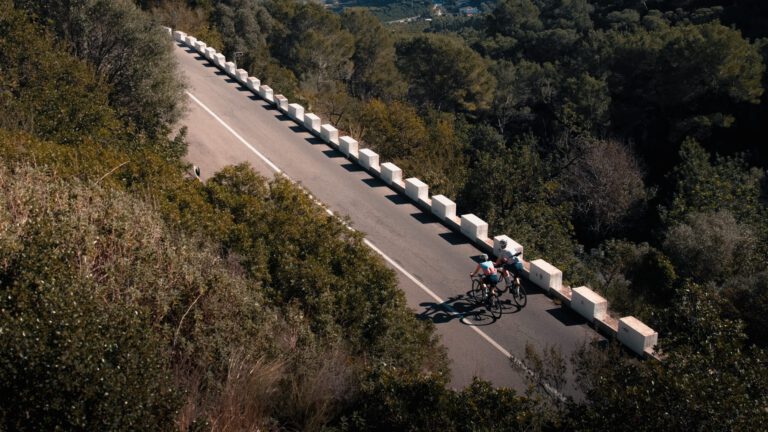
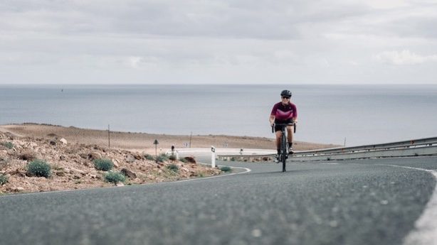
You don’t discover Lanzarote slowly: the island grabs you immediately. The landscape is black and raw, shaped by volcanoes, and the roads run like thin lines through an almost otherworldly setting. For years now, professionals and enthusiasts have been training here in the winter, and there’s a reason for that: quiet roads, good asphalt, stable weather, and climbs that are just enough to prepare you for the new season. Explorer Lotte van Trigt cycled around for us for two weeks.
Why cycle in Lanzarote?
- Compact. The island is 62 kilometers long and 21 kilometers wide. Getting lost is impossible, and you can see all the corners in a week.
- Bike-friendly. Motorists take cyclists into account well; a one-and-a-half-meter distance when overtaking is the norm.
- Wind. You learn to ride against the wind here, and that is in itself a training session. Leave your high rims at home.
- Sport Island. Lanzarote presents itself as a European Sports Destination and attracts athletes from all over the world throughout the year, from triathletes to cyclists.
The most beautiful route: Mirador del Río
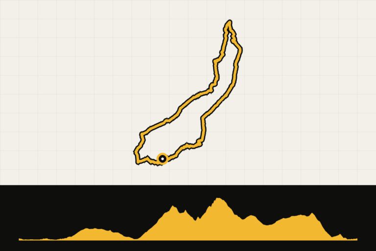
The longest and most beautiful route leads to the Mirador del Río viewpoint in the north. From Puerto del Carmen, you first drive along the promenade to Arrecife and then inland via Tahiche to Arrieta, a hilly and mostly windy route. After Arrieta, a climb of 10 to 12 kilometers begins to the Mirador, not steep but pleasant uphill, with a beautiful view of the island of La Graciosa.
After that comes the celebration. For Haría, a stretch of 200 meters at 24 percent, and after Haría comes the most beautiful climb on the island: just over five kilometers of real hairpin turns to the weather station on top of the mountain. From there, you descend to Teguise and drive through the wine region of La Geria back. A journey of almost 105 kilometers. The famous climb of Tabayesco was closed during Lotte’s visit; check beforehand if it is open again.
Timanfaya and El Golfo
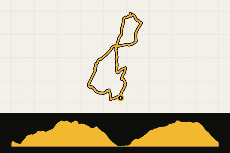
The Timanfaya Nature Park is the heart of the volcanic Lanzarote: the ground is literally lava, with a paved road running right through it. Combine that with El Golfo and the green lake on the west coast. From Puerto del Carmen it’s a round trip of about 80 kilometers: along the coast to Yaiza, via Uga through La Geria up to Mancha Blanca, with the wind along with you through Timanfaya and then a quick, straight descent back to Yaiza. That way you can see all the landscapes of the island in one day.
Finding the wind
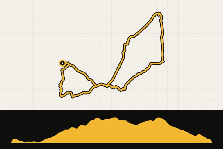
In the northwest, near La Santa and Famara, the wind always blows. It’s wonderful to cycle there, with real sand dunes that sometimes also lie on the asphalt. From Timanfaya, Mancha Blanca and Tinajo you descend to La Santa; back to Soo you climb against the wind, sometimes at 11 kilometers per hour. Good for the character.
La Geria: wine from the lava
Between the volcanoes of La Geria, vines grow in holes in the black lava ground, each behind a half-round wall against the wind. It is one of the strangest wine regions in Europe, and the roads through it are quiet and rolling. Stop at one of the bodegas for a glass of malvasía, of course after the ride.
Starting point: Puerto del Carmen
Lotte stayed in Puerto del Carmen, on the southeast coast. It is close to the airport, you can climb up the slopes right away, and towards Arrecife it is actually a bit flatter. Costa Teguise and Playa Blanca are good alternatives, as is the sports resort in La Santa for those who also want to swim and walk.
What should you pay attention to?
- Wind. The trade winds are almost always from the northeast. Plan long rides so that you return with the wind.
- Sand. There may be sand on the road around Famara. Be careful in the curves.
- Sun. There is little shade on the island. Apply sunscreen, even if it feels cool in the wind.
- Water. There is sometimes a considerable distance between the villages. Take plenty of supplies with you.
Lanzarote in the winter: what can you expect?
Lanzarote is the driest of the Canary Islands. Between December and February, it is usually 20 to 23 degrees during the day, and a rainy day is really an exception. The trade winds are also present in winter, but often less strong than in summer, although they sometimes last for days in a row. In the morning it is cool: start with arm warmers and a vest, because until about ten o’clock in the shade it is still cool. In December it gets dark around six o’clock in the evening.
What to bring?
- Low rims. With high rims, you are blown by the side wind of the road.
- Windvest. For the descents and the mornings.
- Sunburn. There is almost no shade, and the wind makes you forget how hot the sun is.
- Two canisters. There is sometimes quite a distance between the villages.
Climbing more
- Femés. From Playa Blanca you climb briefly but steeply to the village of Femés, with views of the rugged south and the sea towards Fuerteventura.
- The Ironman round. The Ironman Lanzarote cycling route covers 180 kilometers around the island, passing through Timanfaya, Famara and the Mirador del Río. If you don't want to cycle all day, split it up into several stages.
An example week
- Day 1: Drive calmly through La Geria, learning to handle the wind.
- Day 2: Timanfaya and El Golfo.
- Day 3: The big northern round to Mirador del Río and Haría.
- Day 4: rest day. On Sunday there is a market in Teguise.
- Day 5: to La Santa and Famara, with the wind as the opponent.
- Day 6: Femés and the south, or the ferry to Fuerteventura for a day on the neighboring island.
When are you leaving?
From October to April, the temperature is around 20 to 23 degrees Celsius. The wind is always strong; in the summer it is even stronger.
Lanzarote can be visited all year round, but is at its best from October to April, when it is cold in the Netherlands. In the winter, it is about 20 to 23 degrees. In the summer it is warm and often windy.
How do you get there?
- Aircraft: There are direct flights from Schiphol and Eindhoven, and sometimes from Rotterdam The Hague Airport during the winter season. Expect a flight time of about four hours. The airport is located near Puerto del Carmen and Arrecife.
- Cycling: You can either bring your own or rent one; there are plenty of rental shops on the island with good race bikes. Read our tips on Bring your own bike or rent one.
This is how we calculate: We calculate distances and travel times starting from Utrecht. Our flights always depart from Schiphol, Rotterdam The Hague Airport or Eindhoven Airport. Want to know how to travel from your place of residence the best way? Let us know, We are happy to help you. After all, we built this site together.
Are you flying? Read our guide Flying with your bike: Which airline, what the cost is and how to pack your bike.
Also in the Canary Islands
Do you like to combine things, or do you want to compare? Read about Tenerife, Gran Canaria and The rugged heart of Fuerteventura, the neighboring island that you can reach in half an hour by ferry from Playa Blanca.