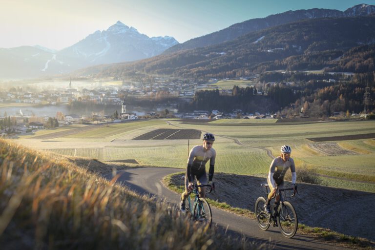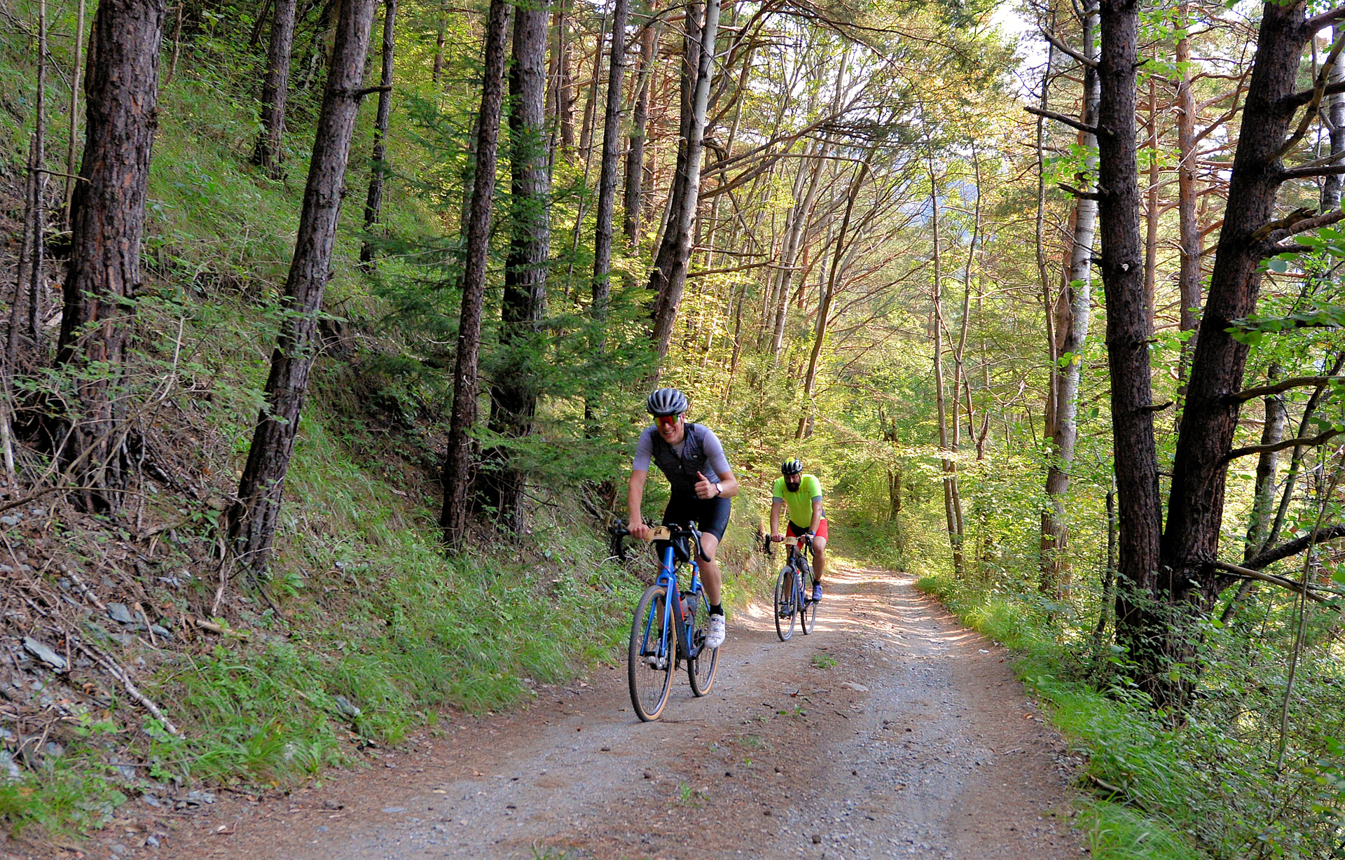
Innsbruck is located in the middle of the Alps, in the valley of the Inn, with the Nordkette on one side and the entrance to the Stubaital and the Brenner Pass on the other. From the city, you can drive into the mountains, making Innsbruck one of Austria's best gravel destinations: forest roads, alpine pastures, plateaus with views of the peaks, and then a terrace in the old town. And for those who want more: Innsbruck is also the starting point for a six-day tour Bikepacking trip across the Alps to Meran and back.
Why gravel biking around Innsbruck?
- From the door, you can reach the mountains: wide forest and pasture roads on the plateaus around the city, such as the Telfer Wiesen above the Stubaital.
- The high plateau of Seefeld and Leutasch, with lakes, open meadows and the Isar towards Scharnitz and Bavaria.
- Lots of variety: from a morning run to the Hungerburg hill of 15 kilometers, to mountain climbing with almost 1,500 meters of elevation gain.
- A real city after the ride, with coffee shops, restaurants and a historic center. And on your rest day, you take the cable car the Nordkette op.
- The gateway to South Tyrol: in six days you bike across the Brenner to Meran and back via the Zillertal valley.
Your starting point: Hotel Seppl in Mutters
We recommend Bike Hotel Seppl in Mutters, on a sunny plateau just south of Innsbruck, at the entrance to the Stubaital valley. It is a four-star hotel that is completely dedicated to cyclists: a closed bike storage area, a work area to tinker with, laundry service for your cycling clothes, bike rental, and own guides. Owner Bernhard himself cycles, and you can feel it. After the ride there is a swimming pond and, in the evening, an extensive dinner with regional dishes. With the Stubaitalbahn (tram) you are in the center of Innsbruck in a quarter of an hour. The hotel is Cycling Destination Approved; read our report.
Two routes start directly from the hotel: you can find them under The gravel routes.
More bike-friendly hotels (Bett+Bike)
We are not the only ones who rate cycling addresses. The German cycling label Bett+Bike from the ADFC recognizes accommodations that are truly designed for cyclists. In the Innsbruck region, these six addresses have the label:
- Alp Art Hotel – Götzens, on the plateau next to Mutters
- Edenhauserhof – Natters, a neighboring village of Mutters
- Hotel Gruberhof (bed & breakfast) – Igls, at the foot of the Patscherkofel
- Hotel Sonnenhof Igls – Igls
- Harry’s home Telfs – Telfs, in the Inndal west of Innsbruck
- Hunting Castle Innsbruck-Kühtai – Kühtai, high in the Sellraintal
A Bett+Bike address means: your bike is safe and dry, there is tools to tinker with and a place to rinse off, and you can also stay there for one night. If something went wrong? Let us know, and we’ll adjust the guide and pass it on to the ADFC.
The gravel routes
Around Innsbruck there are two gravel world circuits. The first starts on the outskirts of the city: the Hungerburg at the foot of the Nordkette, the Telfer Wiesen above the Stubaital and alpine pastures at 1,500 meters like the Hinterhornalm. The second is located on the plateau of Seefeld and Leutasch, with the Leutascher Ache, the Karwendel and the Zugspitze in the distance. By train you are there in 35 minutes.
We combined seven routes, from a 15-kilometer morning ride to a nearly 1,500-meter elevation climb. Number 1 is the Gravel Innsbruck route, the city’s own gravel-cycling event. Download them individually or all at once.
Route collection · Gravel
The gravel roads around Innsbruck & Seefeld
- 7routes
- 15–65km per ride
- 1.486max. altitude meters
- 309km in total
- 1
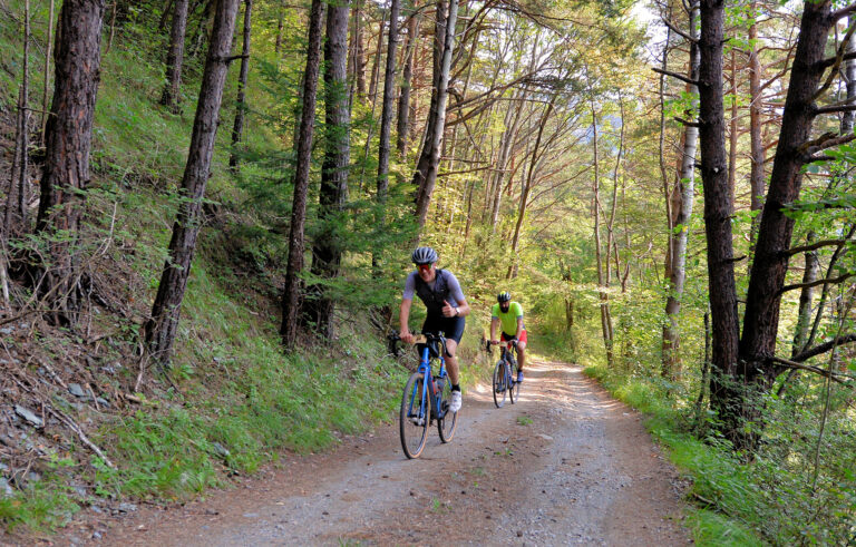 Route 1 · 65.3 km · 1.337 hmGravel Innsbruck: the route of the eventThe route of the gravel event Gravel Innsbruck: 65 km and over 1,300 hm over forest trails, country roads and plateaus around the city, with start and finish in the city center. Lots of short climbs, all day long.Map, profile & GPX of route 1 →
- 2
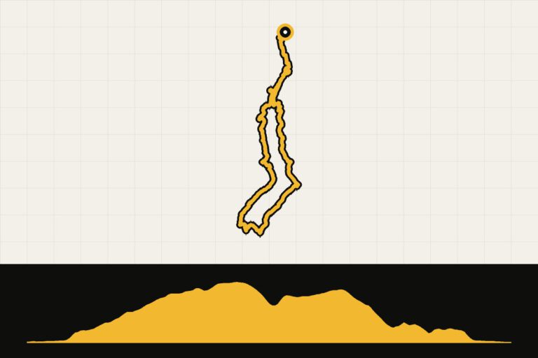 Route 2 · 35.3 km · 738 hmInnsbruck: Old Town – Telfer WiesenFrom the old city center, you climb to the plateau of the Telfer Wiesen above the Stubaital, with a view along the way of the Europabrücke. 35 km and well over 700 hm without really leaving the city.Map, profile & GPX of route 2 →
- 3
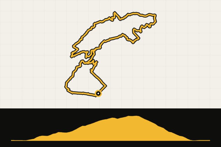 Route 3 · 14.8 km · 381 hmInnsbruck: Hungerburg tourShort and sturdy: over the Emile-Béthouart pedestrian bridge over the Inn and up to Hungerburg, the viewing terrace at the foot of the Nordkette. Perfect for a morning walk or your arrival day.Map, profile & GPX of route 3 →
- 4
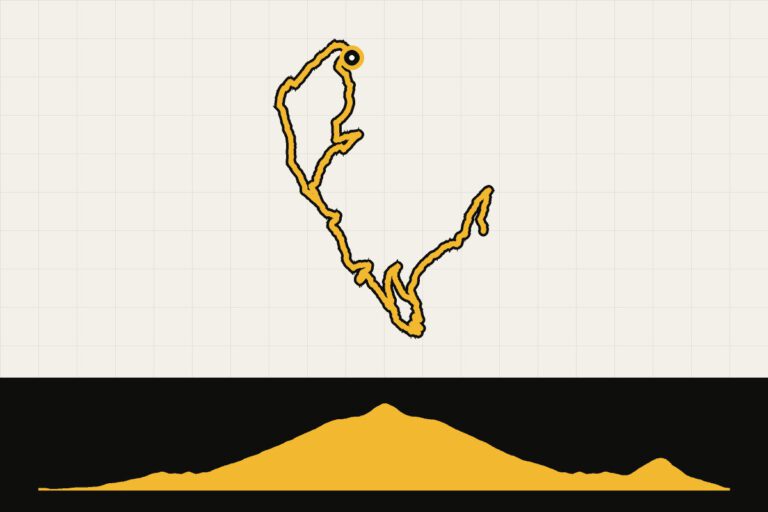 Route 4 · 40 km · 1,356 hmLans – Heiligwasser – PatscherkofelFrom the village of Lans, south of the city, along the pilgrimage church of Heiligwasser, climb the slopes of the Patscherkofel to almost 1,900 meters. Short but tough: 40 km with over 1,350 hm.Map, profile & GPX of route 4 →
- 5
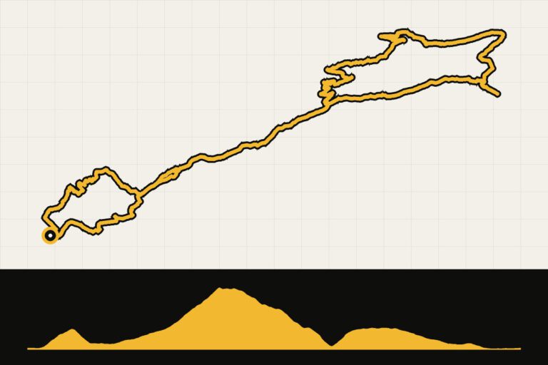 Route 5 · 56.9 km · 1,486 hmInnsbruck – Hinterhornalm – WalderalmEastwards through the Inndal valley to Gnadenwald and the long climb to the Hinterhornalm at over 1,500 meters, with a detour to the Walderalm. Meadows, cows and a vast view of the Tuxer Alps.Map, profile & GPX of route 5 →
- 6
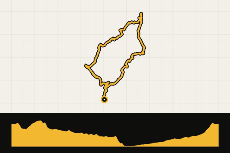 Route 6 · 42.3 km · 441 hmSeefeld: Leutascher Ache – ScharnitzA leisurely ride over the high plateau of Seefeld, along the Leutascher Ache and through forest and meadow paths with views towards Scharnitz and the Karwendel. Few elevation meters, lots of nature.Map, profile & GPX of route 6 →
- 7
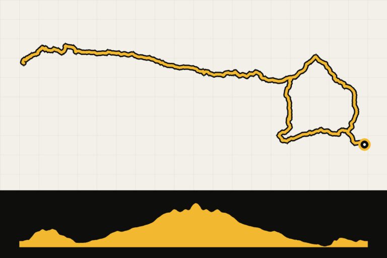 Route 7 · 54 km · 970 hmLeutascher Ache – SeebenseeThe classic climb on the plateau: from Seefeld along the Leutascher Ache and through the Gaistal up to the Seebensee at over 1,650 meters, below the Zugspitze.Map, profile & GPX of route 7 →
If you’re staying in Mutters, you’ll have the Telfer Wiesen right outside your door: Mutters – Neustift – Telfer Wiesen (41 km, 870 hm) and Mutters – Telfer Wiesen – Krössbach (46 km, 720 hm).
The routes are based on Komoot tours from the guide Mountain biking around Innsbruck-Land.
Bikepacking: Six days across the Alps to Meran and back
Innsbruck is not only a great base for day trips; it is also the perfect starting point for a real adventure. In six days, you cycle with your luggage over the Alpine main ridge to South Tyrol and back: over the Brenner Pass, along the Jaufen Pass to Meran, over the Penser Joch and the Pfitscher Joch to the Zillertal, and via the Geiseljoch back to the city. Austrian chalets and Italian espresso alternate, and every evening you sleep in a different valley.
The numbers don't lie: 369 kilometers and almost 11,000 meters of elevation gain, Divided into stages of 46 to 75 kilometers. The majority of the route is gravel, forest roads and quiet asphalt climbs, with five sections above 2,000 meters. In some places it is so rough that you have to stop and push a little bit. That’s part of the adventure.
What do you need?
- Cycling: A gravel bike with tires at least 40 mm (43 mm is ideal) and a light gear. With luggage on the bike, you want to climb up with your smallest effort.
- Luggage: Lightly packed with a frame, saddle and handlebar bag. Bring a rain jacket and a warm layer: at 2,200 meters, it can be chilly in August as well.
- Sleeping: Gossensass, the Jaufental, Meran, Sterzing and Ginzling all have guest houses, hotels or mountain inns. Book in the high season in advance.
- When: from the end of June to mid-September, when the slopes are snow-free.
Multi-day adventure · Bikepacking · Gravel
Off-road through South Tyrol
- 6days
- 369km
- 10.910altimeters
- 61km per day
- 1
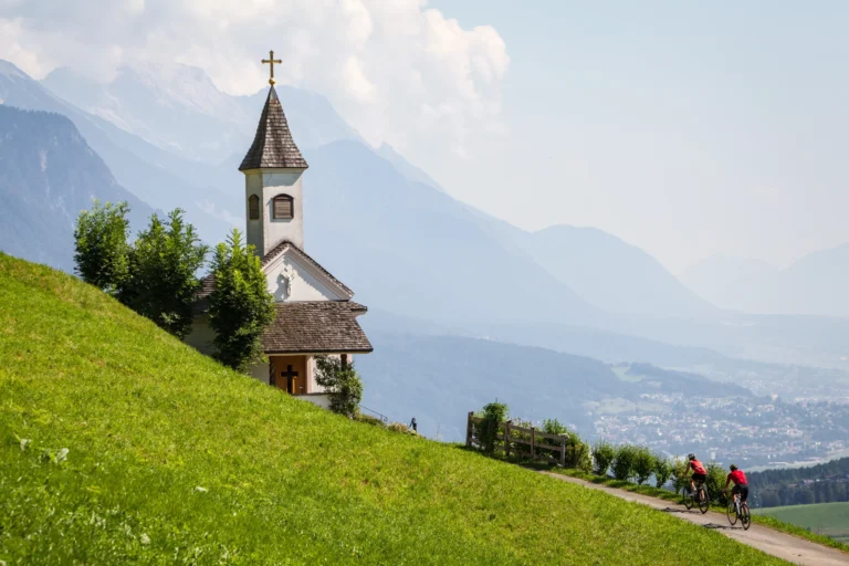 Day 1 · 68.1 km · 2,240 hmInnsbruck – GossensassFrom Innsbruck, head into the Wipptal via forest and pasture roads to the border pass near the Brenner and at over 2,200 meters enter Italy. After that, a long descent to Gossensass.Map, profile & GPX from day 1 →
- 2
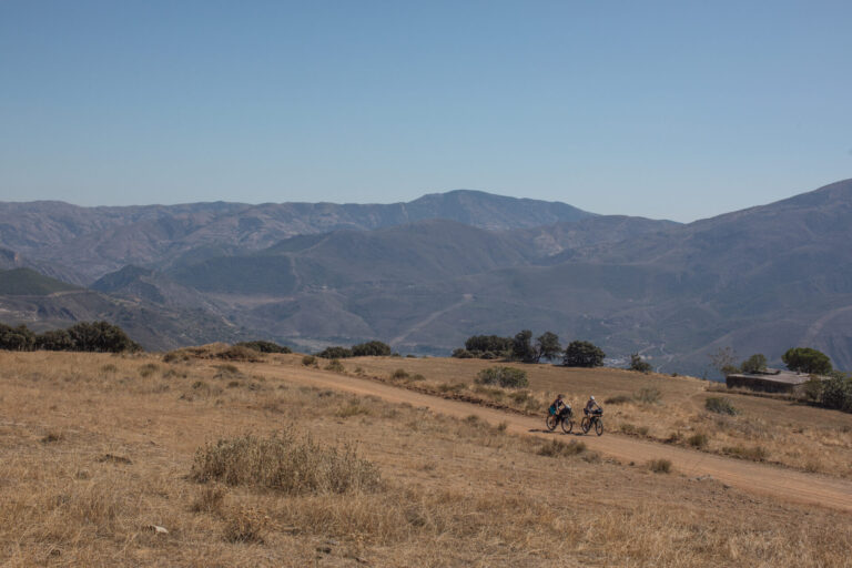 Day 2 · 45.7 km · 1,620 hmGossensass – JaufentalA shorter day through the side valleys around Sterzing: the Pflerschtal valley, climbing up to over 1,800 meters and via Sterzing to the quiet Jaufental valley.Map, profile & GPX of day 2 →
- 3
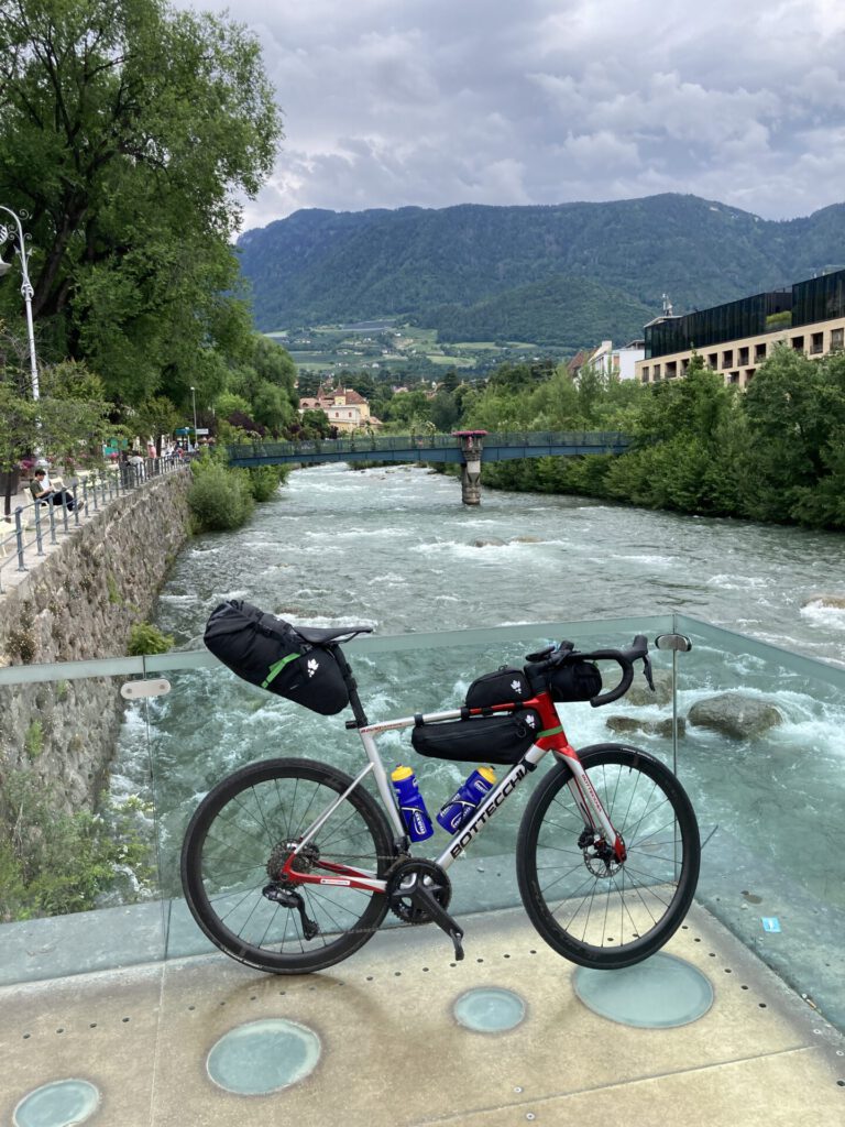 Day 3 · 50.9 km · 1,180 hmJaufental – MeranOver the Jaufenpas flank just above the 2,000 meters, then the long descent through the Passeiertal to Meran. Palm trees and espresso as a reward.Map, profile & GPX of day 3 →
- 4Day 4 · 75.4 km · 2,590 hmMeran – Penser Joch – SterzingThe queen’s route: via Hafling to the high plateau above Meran, through the Sarntal and all the way up to the Penser Joch (2,215 m), descending to Sterzing.Map, profile & GPX of day 4 →
- 5
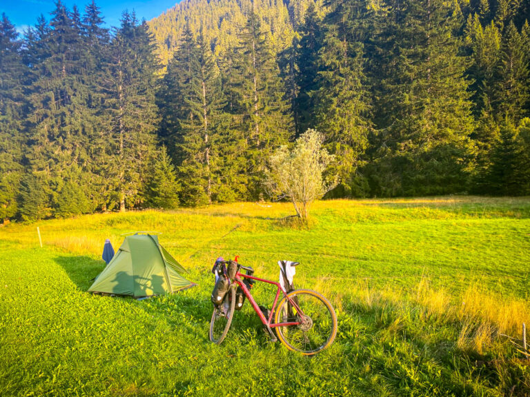 Day 5 · 56.7 km · 1,450 hmSterzing – Pfitscher Joch – GinzlingFrom the Pfitschertal to the Pfitscher Joch at over 2,200 meters, with some pushing. On the Austrian side, the Schlegeis dam lake and a long descent to Ginzling.Map, profile & GPX of day 5 →
- 6Day 6 · 71.8 km · 1,830 hmGinzling – Geiseljoch – InnsbruckFrom the Tux valley to Geiseljoch (2,292 m), the highest point of the hike. Then we descend to the Weertal valley and along the river back to Innsbruck.Map, profile & GPX of day 6 →
This tour is based on the Komoot collection Off-road through South Tyrol: 6 days of biking in Austria and Italy. The distances and altimeters come from that collection.
Day without a bike: the Nordkette on
Plan one day off, and spend it on the Nordkette. It’s spectacular. From the center of Innsbruck, the Nordkettenbahnen take you in three stages to the Hafelekar at 2,256 meters: first with the Hungerburgbahn, with stations designed by Zaha Hadid, to the Hungerburg, then by the cable car via the Seegrube to the top. Within half an hour, you’ll be standing outside your cappuccino in a mountain valley, with the city and the Inndal on one side and the rugged peaks of the Karwendel on the other.
Or bring your bike up with you
Do you like downhill riding? Take your bike on the Hungerburgbahn and the Seegrubenbahn (the bike is not allowed on the Hafelekar). Just below the Seegrube, the Nordkette Singletrail begins, one of the steepest downhill trails in Europe. It is only for experienced downhillers on a fully equipped bike; it is not for your gravel bike: rent a downhill bike in the city and bring protection with you. Tip: Ride from the city to Hungerburg yourself via our Hungerburg tour and get in there.
In the Hungerburgbahn, your bike is free before 10:00 a.m. and after 4:30 p.m.; in the Seegrubenbahn, you always pay for your bike, and it must be clean. Check in advance the times and whether the trail is open. nordkette.com.
Or go to the Alpine Zoo
With children, or in the mood for something quieter? Get off at the intermediate stop Alpenzoo. It is Europe’s highest-altitude zoo, featuring only animals from the Alps: chamois, chamois, brown bears, wolves and otters. A beautiful morning, and after that you’re back in the city with the Hungerburgbahn.
Coffee: Unbound coffee shop
For good coffee in the city, head to the unbound coffee shop at Anichstraße 44, not far from the old city. Specialty coffee, a terrace where you can sit in cycling gear, and open every day from 7:10 to 18:00. Ideal as a starting point or end point for a coffee ride. You can find more bike cafés on Ravito.
Food: Our tip is the Stiftskeller
After a day of gravel biking, you just want to eat well. At Hotel Seppl you’ll be well catered for, and next door there’s a good Asian restaurant, but our tip is the Stiftskeller, right in the old town at Stiftgasse 1 (Franziskanerplatz). Tyrolean specialties like the Innsbrucker schnitzel, Augustiner beer from Munich, and a beer garden in the summer. The kitchen is open every day from 11:00 to 22:00. Check out stiftskeller.eu.
More restaurants
These are very relaxed places to go for a meal or drink. Not all of them are convenient to get to by bike, but they are great for hanging out.
- Gasthaus Anich: simple Tyrolean classics like schnitzel and kaiserschmarrn.
- Goldener Adler: historical address (since 1390) with Tyrolean greenery.
- Strudel-Café Kröll: strudel in all flavors, from apple to savory with spinach and feta.
- That Wilderin: regional dishes with ingredients from the Alps.
- Restaurant Blum: completely vegetarian and creative.
- Weinhaus Tyrol: wine bar with Austrian wines and small snacks.
- Bergisel SKY: breakfast or lunch on top of the ski lift, with a view over the city.
- Das Schindler and Lichtblick: for a festive evening, both in the Michelin Guide.
Gravel paradise Karwendel
Three gravel routes through the Karwendel Mountains between Garmisch-Partenkirchen, Mittenwald and the Achensee, ridden in the summer of 2026.
Route collection · Gravel
Gravel paradise Karwendel
- 3routes
- 88–90km per ride
- 2.478max. altitude meters
- 268km in total
- 1
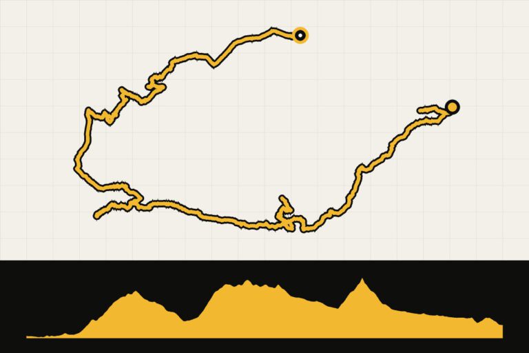 Route 1 · 88.4 km · 2,456 hmKarwendel gravel 1: Garmisch-Partenkirchen to LeutaschUnder the Zugspitze, on to Leutasch.Map, profile & GPX of route 1 →
- 2
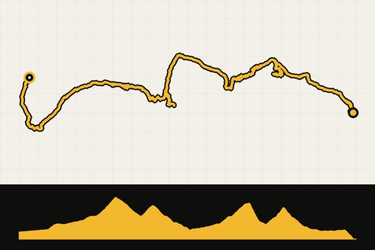 Route 2 · 89.7 km · 2,478 hmKarwendel gravel 2: Mittenwald to JenbachAcross the Karwendel to the Achensee.Map, profile & GPX of route 2 →
- 3
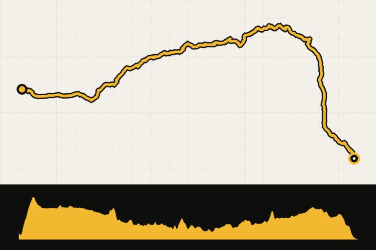 Route 3 · 90 km · 1,239 hmKarwendel gravel: from the Achensee to LenggriesAlong the Achensee to Lenggries.Map, profile & GPX of route 3 →
Climber map: the most important climbs
On this map you can see the most important ascents in the area. Click on a point for the altitude and the climb figures. The yellow points have a GPX route attached.
When are you leaving?
June to September are ideal. In May and October you can still drive, but there may still be (or already has been) snow on the higher plateaus.
From May to October. In the valleys you can often drive as early as the end of April, but on the higher plateaus there can be snow until June. In winter, Innsbruck is a ski destination: then the gravel roads are covered in snow and it is not a gravel season.
How do you get there?
- By train: The Nightjet runs directly from the Netherlands to Innsbruck at night. You get on in the evening and wake up in the Alps. Book your seat in time, even for your bike.
- By car: From the middle of the Netherlands it is about 950 kilometers, about nine to ten hours of driving via Germany.
- By plane: Direct flights to Innsbruck are mostly available during the winter sports season. In the summer, you usually fly to Munich and travel by train or car (about two hours).
This is how we calculate: We calculate distances and travel times starting from Utrecht. Our flights always depart from Schiphol, Rotterdam The Hague Airport or Eindhoven Airport. Want to know how to travel from your place of residence the best way? Let us know, We are happy to help you. After all, we built this site together.
Are you flying? Read our guide Flying with your bike: Which airline, what the cost is and how to pack your bike.
Looking ahead: Tour of the Alps
In April, the Tour of the Alps often starts in the Innsbruck region. In 2026 (the tenth edition, April 20 to 24), the first stage began in Innsbruck and the second in Telfs; afterwards it went via Trento to Bolzano, a total of 760 kilometers and 14,620 meters of elevation gain. A great opportunity to see the pros up close if you’re in Tyrol in the spring.
Source: Innsbruck Tourismus, press release about the sports events in 2026.
Sources
- Innsbruck Tourismus – press release for top sports events 2026