There you are by the pool. Still recovering from that 60 km solo MTB tour in 38 degrees. Enjoying some shade with your wife. Time to read a book. Or a cycling magazine, of course. Suddenly three words catch my eye. Alpine. Panorama. Route. Each word makes me instantly happy. Because how I love the mountains. How much I love beautiful views. And how I love being on the road by bike. Two numbers make me gulp, though. 500 (kilometres) and 9000 (altimeters). Yet I am starting to dream. How cool it would be not to focus on speed for once, but on six days of just being on the road. Dreaming becomes planning. Let's do this in pairs. My very best friend and myself. No pressure. No alpha males on bikes. Just two friends experiencing a cycling journey.
Text and photos: Olivier Niclaus
Doubt
A month before departure, some doubts do strike. Will the 2,500 kilometres I have in my legs be enough to ride the Alpine Panorama Route? Shouldn't I have trained elsewhere than in the Flemish Ardennes? Is my packing list for this trip is complete? We go through the latest information and are relieved that we are not going for the ultimate bikepacking adventure (yet). That 10-litre bag on the saddle will be enough extra weight.
Read also:
Starting at last
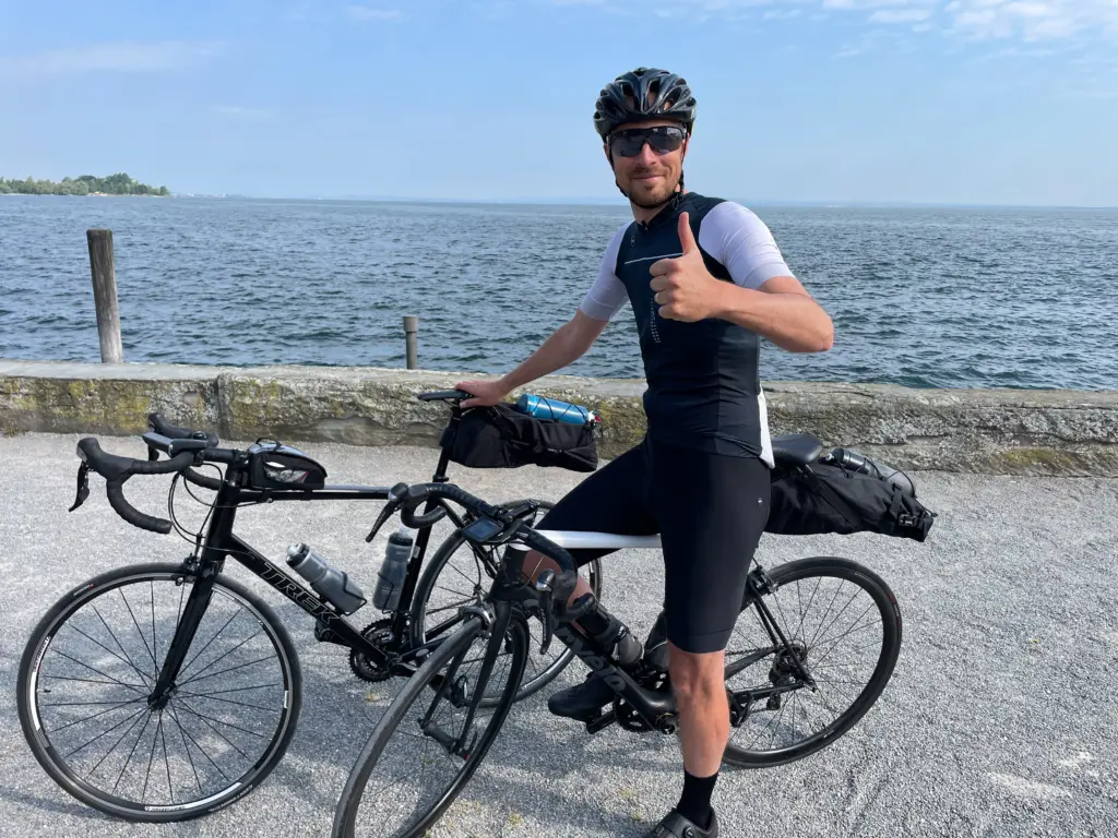
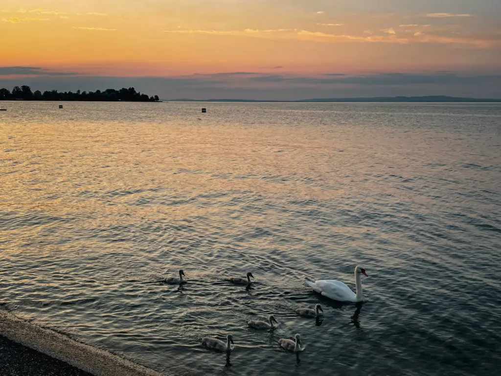
In early June, the time has come. We stay in the town of Rorschach, on the beautiful Lake Constance. Especially in the evening, at sunset, this is a beautiful lake. But the town itself turns out to be past glory. Pats cars find their way through roads lined with abandoned hotels. Meanwhile, it is nine o'clock in the morning. We check our room at least 10 times. We haven't forgotten anything, have we? Because tomorrow and the day after and euh ... the whole coming week we will need our equipment.
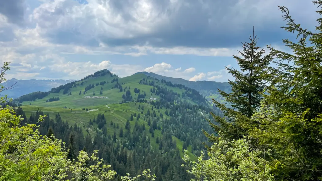
Ready for departure. We are not even 500 metres away and the first lanes are already going up to 10%. We look at each other for a moment and think the same thing without saying it out loud. What have we started? Once at the top, we reach a plateau along Lake Constance. The same Bodensee as before. But this time in an oasis of calm. We rest for five minutes in the village of Walzenhausen. We see a first mountain train. Magnificent birds of prey fly just above us. Enjoyment to the bone.
High peaks
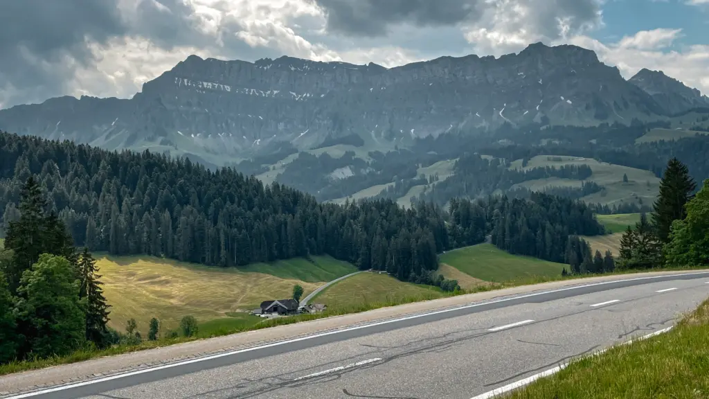
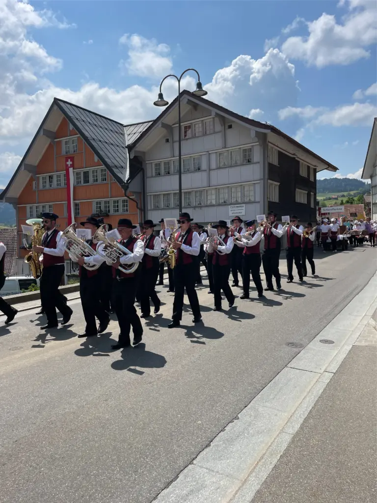
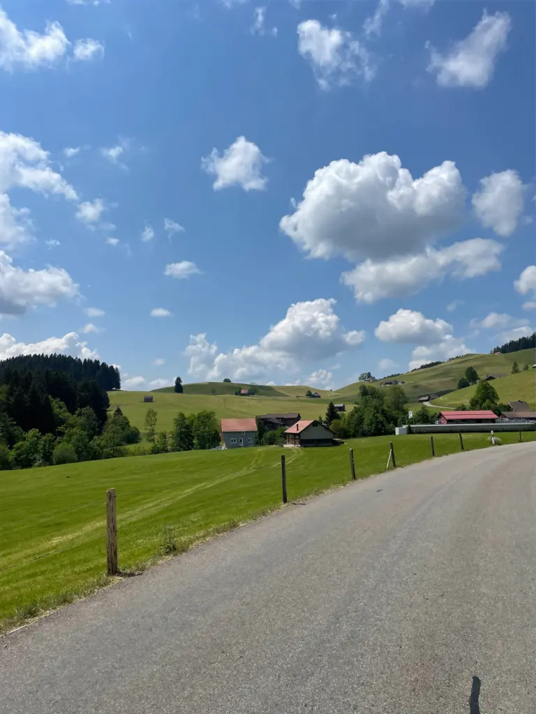
I know Switzerland Of the high mountain peaks. Not of the Appenzeller region. But what a beautiful area for cycling. The whole time we cycle at an altitude of about 800 metres. Near Appenzell itself, we have to set foot for a brass band and procession from the local school. Well, 'have to'. In Belgium, I would already get slightly impatient. Then I want to grind for kilometres. Here, we spontaneously decide to pull over to the side of the road and watch. For minutes at a time. And I don't have to tell you how nice it was that the local baker joined the procession and let us taste his delicacies. That tastes good after 55 kilometres up and down the road.
The mountains call to us
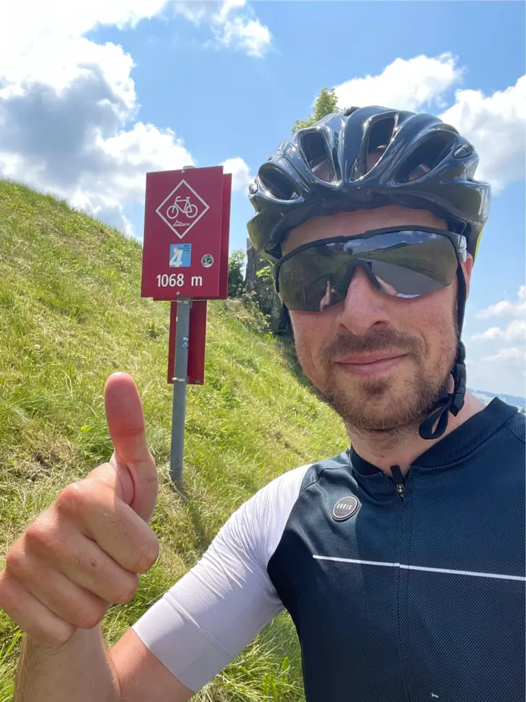
A little later, the time comes. We pass the 1,000-metre altitude mark for the first time. The mountain will undoubtedly have a name, but at that moment that is secondary to the obligatory selfie. I proudly pose in front of the sign that reads 1,068 metres. At that moment, it dawns on me that our trek has really begun. We have just conquered our first 'mountain'.
The terminus of the first ride comes into view. In mainly downhill we head towards Lichtensteig (not to be confused with Liechtenstein). Our GPS indicates a total of 90 km. The signal to enter the local supermarket and buy a bag of crisps. That tastes, as an aperitif. That evening, we already take a look at tomorrow's ride. A glance at the altitude profile leads us to suspect that the 2the day immediately the main course is on the menu.
Lucky weather
Day two has arrived. We are lucky with the weather. They predict another day with plenty of sunshine. My friend wants to bring his mackintosh. Since I know a bit about the weather phenomena in the mountains anyway, I tell him he is quite right. Because in the mountains, it can turn around in an instant. But I am not reasoning rationally at that moment. I feel so intensely happy looking outside that I decide not to bring my mackintosh. Because look at the sky. Impossible that it will rain.

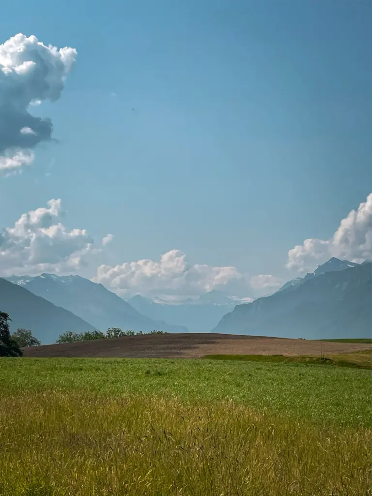
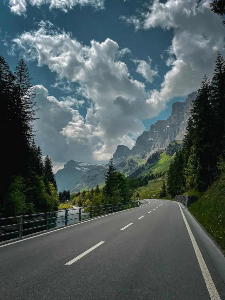
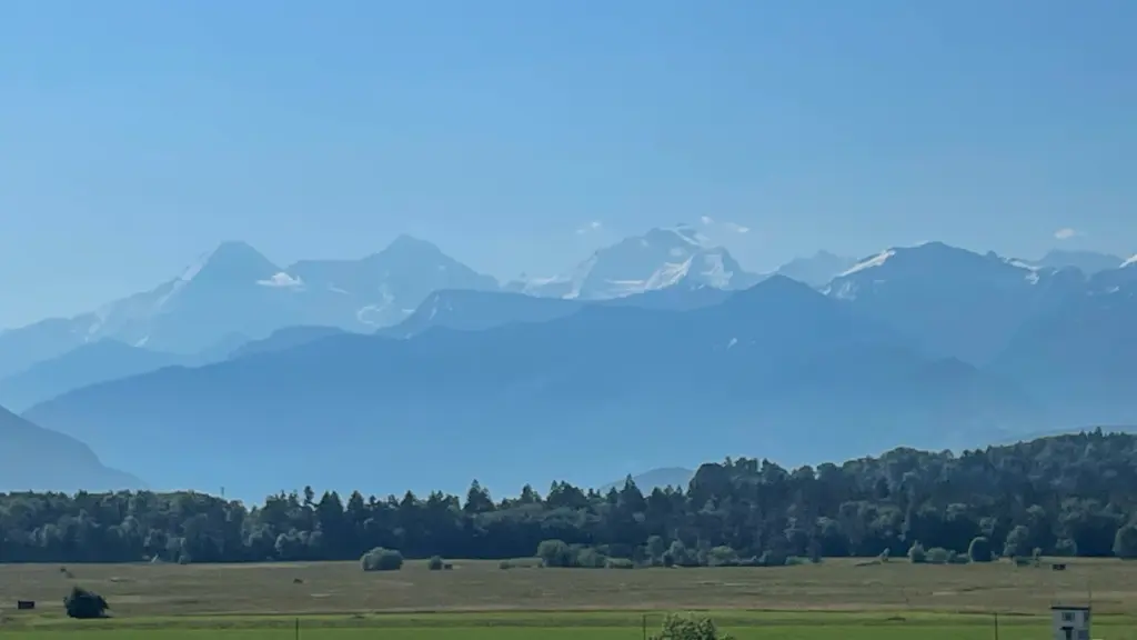
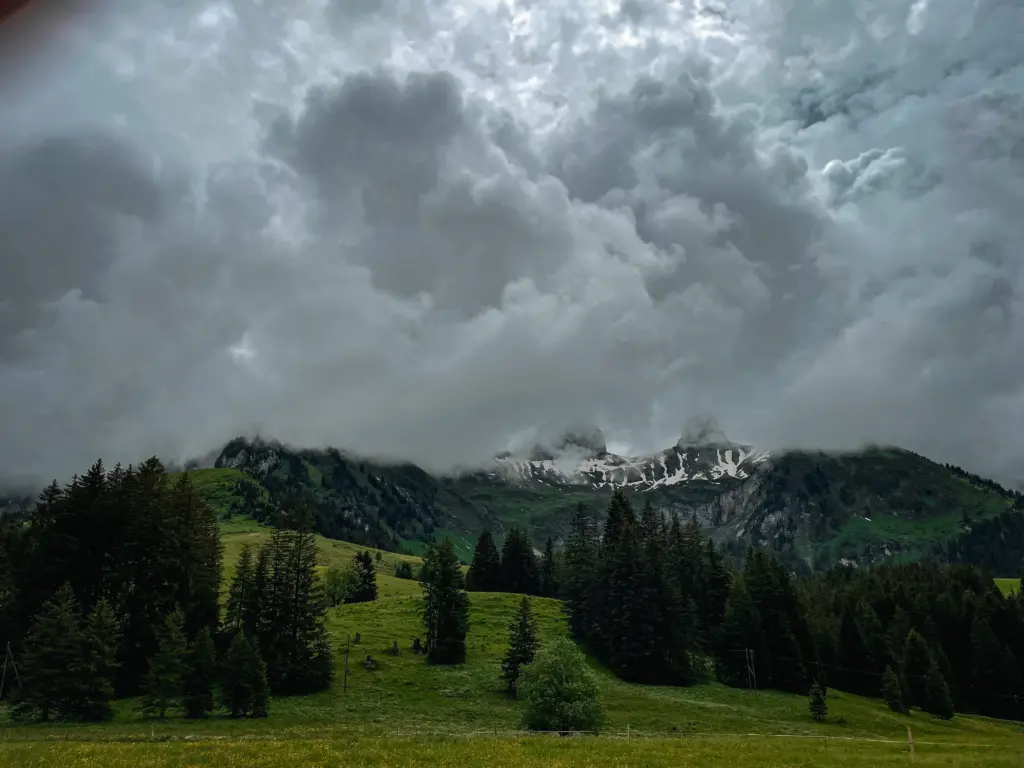
It already seems to be a tradition. This day, too, begins with strips that move smoothly towards the 10%. But that initial effort is followed by 50 rather quiet kilometres through the valley. Everywhere you look, left and right, back and front, you see beautiful landscapes. In the distance, mountain peaks with eternal (hopefully, right?) snow are already peeping out. Steadily, they get bigger and bigger. And we get smaller and smaller.
Klausen Pass
After a few unpaved stretches, the first (and thankfully last) breakdown also strikes. A flat rear tyre. We seize the moment to take in some more energy. Because there it looms before us. The first Alpine col of our trip, the Klausenpass, 22 kilometres long in total. I am looking forward to it. We decide to stay together as long as possible. Because hey, it's a cycling trip. Not a race trip. The sporting challenge lies in the fact that we are at the foot of an Alpine giant that we will climb by bike.
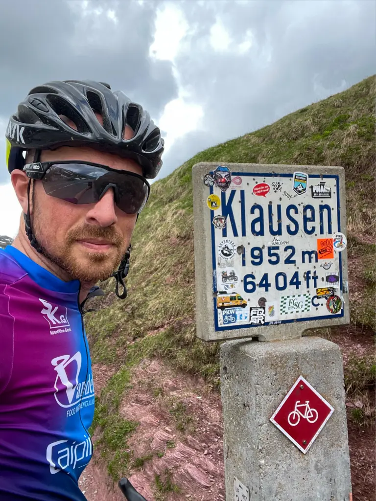
Most beautiful col (so far)
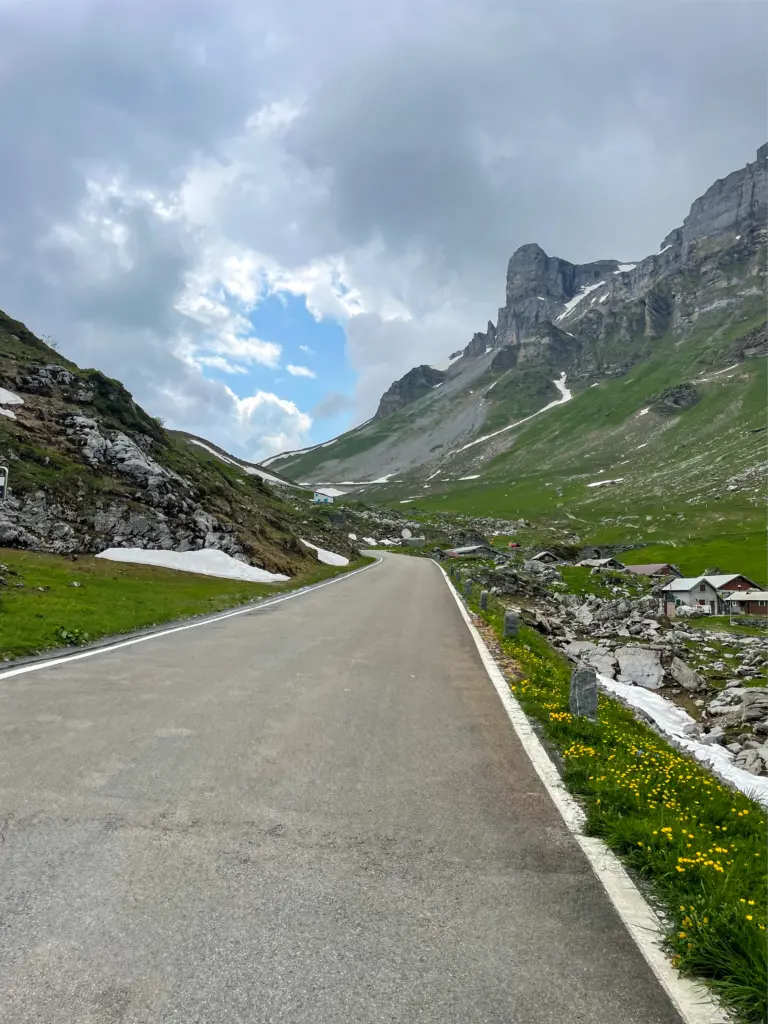
This is the most beautiful col I have already climbed. Maybe that's because I haven't done enough cycling trips yet. But the Mont Ventoux and the Grand Ballon are nothing against it. Those are highways. Here we are on a bikeostrade and hear the mountains. We climb from 400 to 1,952 metres altitude. We see the landscape getting prettier and prettier. At first, the views over the valley are beautiful. But once on the intermediate section - yes, those few kilometres at two to three per cent did feel good - you are truly at the mountains. Be part of the panorama. The last eight kilometres again go to percentages of around 7%. It is on that stretch that I wave off my friend. I do now want to get to that summit as soon as possible. Because I know I will be treated to new views there again. Once at the top, the selfie follows. And I curse that I can't go 48 metres higher.
Out together, home together
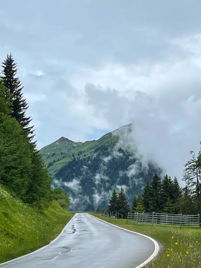
It is now waiting for my friend as clouds suddenly appear. The clouds grow thicker and thicker. We have a drink together, and get ready to start the descent. And just then. Just as we are over the crest of the mountain, the unpredictability of the mountain is revealed. Pouring rain, hail even. There I am. Without a rain jacket. At the foot, the thermometer read 28 degrees. Up here, 4 degrees. I put on another wind jacket and shivering, I start the descent. With the daver on my body, but fortunately the warmth meets us again. Descending will never be my favourite discipline. But for enthusiasts, this 1,500 layer meters enjoy. At the foot, we are again almost dry and our little hotel awaits. Paradoxically, but we rush to the shower. Tired but satisfied, we enjoy a lavish pizza in the evening.
Another beautiful day
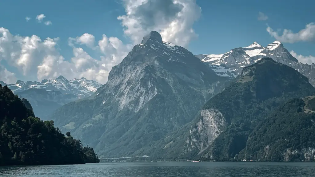
Thanks to the recup shake, legs feel fresh at the start of day three. At breakfast, we take in the day's altitude profile. A long flat approach, with the Glaubenbielen towards the end. That name means nothing to us then. We need to practise pronouncing it correctly. Before setting off, we inform ourselves and decide to ignore the dangerous Axenstrasse. After all, the start of the stage is at Lake Lucerne (near Fluelen) and we have to cross that lake anyway. We opt for a boat crossing. Is it thanks to the weather that is once again glorious? Is it thanks to the fantastic panorama you see? On the boat, it was downright enjoyable and I realised once again that we were experiencing a real cycling trip.
Foot on land
Once docked in Beckenried, we have 30 km to recharge our legs for the next Alpine Col. Those kilometres are the least scenic of the trip. It does make me realise that even Switzerland, that beautiful Alpine country, needs industry to be economically strong. Switzerland is not just a holiday and tourism country. Then the Swiss Franc would not be as strong as it is now.
Glaubenbielen - unknown but not unloved
And then it is marked. The Glaubenbielen. 12.3 km at 9.1% average. What a horror. My GPS indicated 12%, indicated 14%, even indicated 17%. An intermediate stretch of 7% suddenly felt like false flat. In the beginning you have beautiful views of the Samersee. Afterwards, you dive into the woods. But it never gets boring. The views remain beautiful. However, it becomes all the more gruelling. Already at the foot, we decide to ride up this col at our own pace. We have no breath to talk to each other anyway. At the top followed the reward with another restful view. From there, it's downhill to Sörenberg and quietly roll into the next hotel. I will forever pronounce the name Glaubenbielen correctly.
Halfway
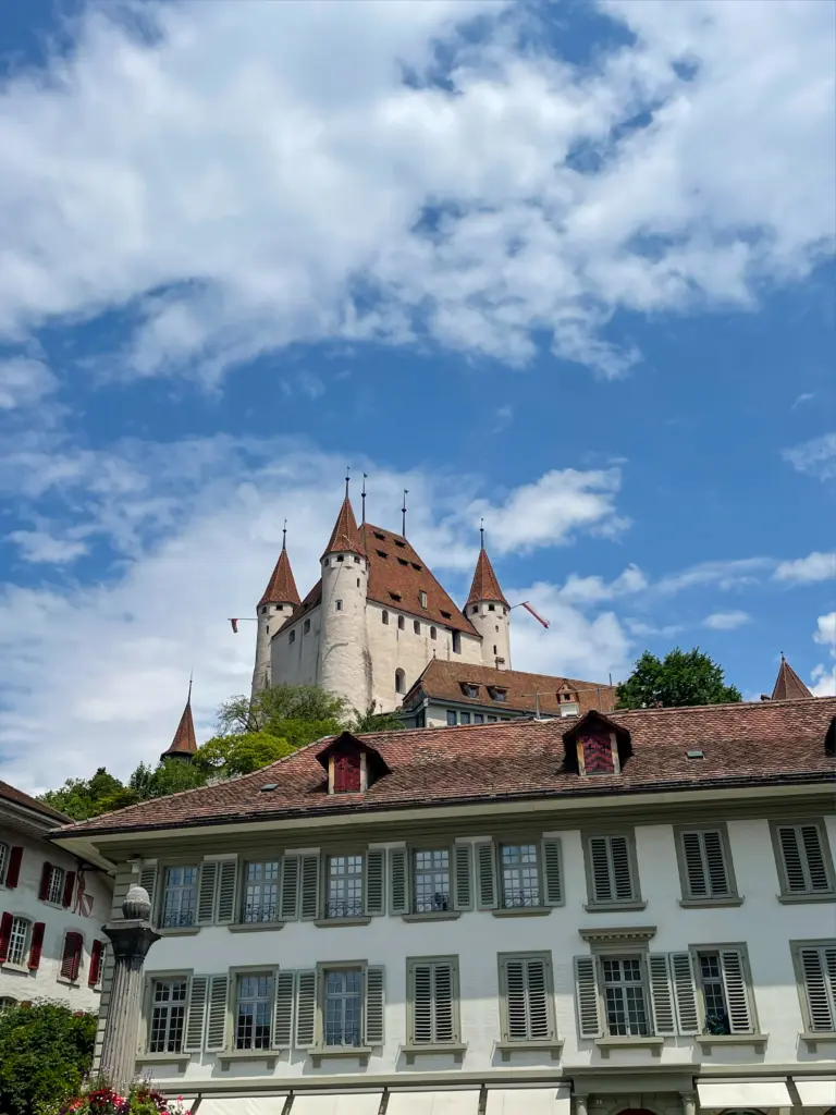
We are halfway through and wow, how much those two Alpine cols have cut into it. On day 4, I wake up as if I had just slept for days. That was satisfying, as was the sumptuous breakfast. We also had a bit more time. Because today a short 65km ride is on the programme. Today's only real climb would be at most 3the category scoring in the Tour De France. So, for once, a day without 'hors categorie'. Time to take photos and enjoy a tasty Swiss lunch dish atop the Schallenberg. We then continue to Thun, the day's destination. A fairly touristy but very pleasant and beautiful town. Because of the short distance, we arrive as early as 3pm, giving us time to recharge our batteries and enjoy a snack and a drink. A welcome quiet day of cycling.
We continue
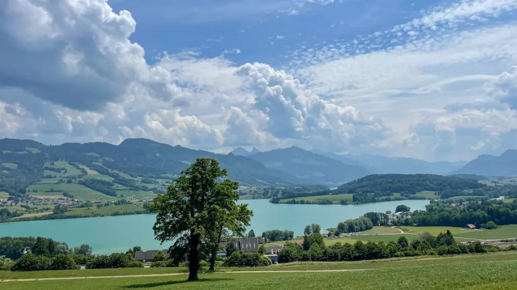
Meanwhile, 340 kilometres are already on the counter. Well over halfway, but no point in counting down. We have barely left Thun and are still enjoying the view of the Alpine giants and the Jungfrau when we are reminded of the tradition of the first two stages. BAF, there are the double-digit gradients again. This time the thing is called the Hubel 4. Just under three km and 9% average. On an altitude profile over 500 km, you don't even notice it. But it will be crawling. The legs are still in tourist mode. With that, we do have the hardest part of the ride immediately behind us.
The next 75 km were not a metre flat, but did take us over a very nice course. We were spoiled with some nice surprises like the rocks in Sankt Antoni, the beautiful city of Freiburg - or rather say Fribourg, because from here on Switzerland became French-speaking and no longer German-speaking - and the 15 km along the Lac de La Gruyère.
Cheese
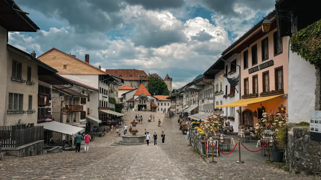
The name of the lake held a (not so) hidden message. It told us the name of the town to which we were heading, Gruyères. Known and loved for its delicious cheese. The sight of the tourist attraction is truly fantastic. From miles away you can see the town on a hill, surrounded by a city wall. In the town you imagine yourself in the Middle Ages, as the first settlement was already here in the 10th century.the century. Occasionally, we too get tempted by the tourist attractions, so we decided to indulge in a cheese fondue for the last evening. Admit it, if you don't eat cheese fondue in Gruyères, where in the world can you?
Final destination Aigle
The last 70 kilometres. After the deluge on the Klausen Pass, we were suddenly introduced to rain again after all those days of sunshine. However, the raindrops had no impact on our spirits, as it provided plenty of oxygen in this forested area. For about 40 kilometres, we went uphill from an altitude of 700 metres to 1,500 metres. A ride without any traffic. Feeling completely alone in this beautiful and yet somewhat rugged region.
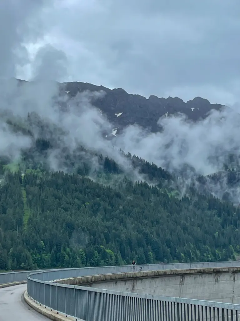
The highlight of the ride is the reservoir on Lac de l'Hongrin. With this route, you cycle both north and south around the reservoir, giving an almost 360° view of this artful structure. After a final acceleration (finally lactic acid!) towards the summit, we dove into the descent of Les Agites. An 11km descent at almost 10% average.
High test completed
Once down comes the realisation that this is a fantastically beautiful cycling route. From the border with Germany to the border with France. I can say that I have 'crossed Switzerland by bike'. And not just like that. But via the Alpine. Panorama. Route. None of these 3 words lied. Just when I want to switch off the GPS, the screen displays 'you are adapted to life at an altitude of 800 metres'. My first altitude training. More or less, anyway.
Alpine Panorama Cycle Route
Overnight stays
During our trip, we stayed at the following hotels. Recommended to anyone with a bike on the Alpine Panorama Route. All good locations to stop at. For alternatives, you can also check out the various Swiss Bike Hotels, where you will find all amenities for cyclists (such as lockable rooms for your bike, key sets and rinse-off spots) in every hotel.
- Hotel Mozart (Rorschach): A beautiful, small-scale hotel (35 rooms) in Mozart style, close to Lake Constance. It has to be a bit your taste but it's a good start to this adventure.
- Hotel-Café Hüber (Lichtensteig): A great stop along the way, where you will find basic facilities for an overnight stay.
- Hotel Höfli (Altdorf): This comes highly recommended. The pizzas from the wood-fired oven are rich and the hotel has good facilities.
- Hotel Rischli (Sörenberg): Spacious rooms and a practical hotel. The presence of spa & wellness treatments here is also a plus. A little past halfway and then be able to relax well.
- Hotel Krone (Thun): A sustainable accommodation spot in Thun. A good restaurant and comfortable rooms.
- Hotel de Gruyères (Gruyères): Enjoying this cheese city. This hotel offers a nice bit of extra support and relaxation, after a long day on the bike. Wellness and massages are available. The view is also worth it. Cheese fondue is a must.
Other tips:
- When you get to the finish in Aigle, you should actually drive on to the Centre Mondial du Cyclisme, the home of the UCI. This beautiful complex breathes cycling. Walking in and having a cup of coffee (or lunch) will absolutely please. Who knows, you might run into future or former champions!
- Along the way, you pass Lake Lucerne. You can take a small corner to Lucerne, a beautiful place, where the medieval Kapelbrucke is a beautiful monument. A few kilometres detour!
2 responses
Good evening, I am planning this route.
Is there a gpx to download here on komoot.
I can't find these anywhere. But want to have that one for my wahoo, or is the signage very good?
Bvd for the reply.
Bye Kris, I'm going to take a look, but if it's all right.