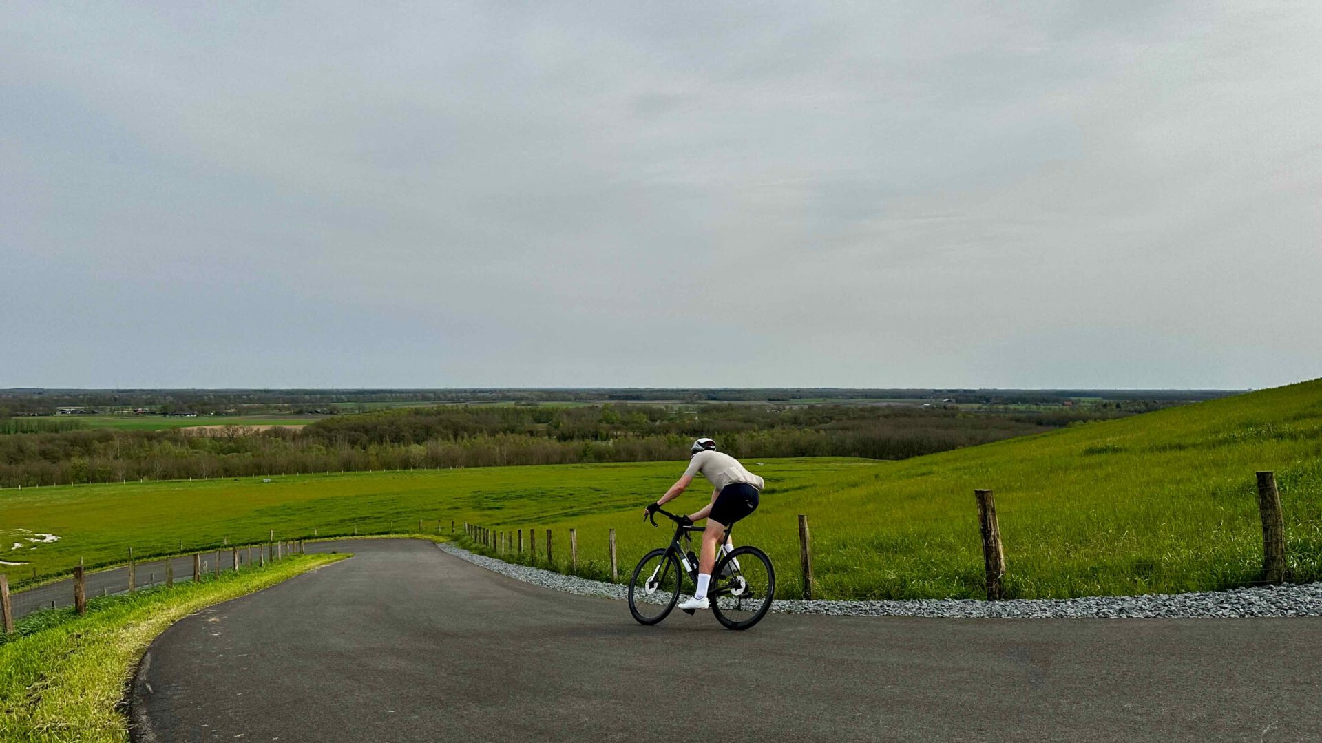
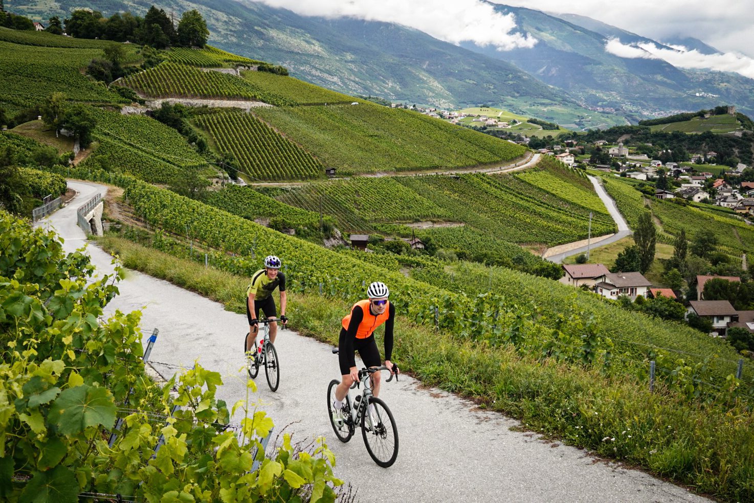
Ruth Koops van 't Jagt was for our platform a week in the Canary Islands and specifically Gran Canaria! That this island can be a wonderful escape from reality is clear from the first part of her report, which appeared on Cycling Destination a little while ago. Again, there are great tips and tricks. This time nicely off-road and even a nice hike! Well, sometimes you have to think off the beaten track. We are totally enthusiastic about this island and the possibilities for cycling and being active. Check out the report below. Happy reading! Cycling in Gran Canaria is beautiful off-road too! Read the sequel to this part 2 here and read the first report here!
MTB with Santiago
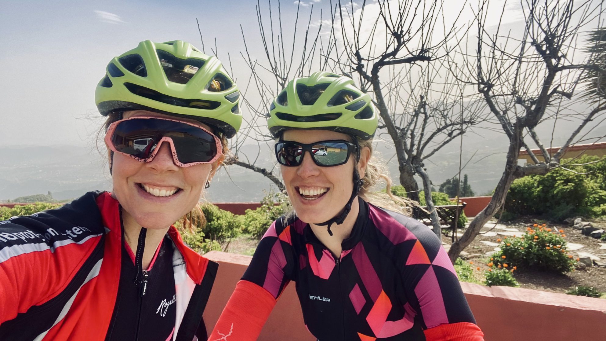
Ever since we boarded the plane, we have been looking forward to this Tuesday, with the expectant butterflies you felt as a child before your birthday. In the Netherlands, we conquer the climbs and singletracks of Gieten Gasselte together on the MTB. So on our wish list for Gran Canaria stood at least one nice mountain bike tour, preferably with a guide. We still know little about what exactly to expect, so we warned Santiago by app. 'We are really recreational cyclists' we send him. Fortunately, we received reassuring words back: 'Don't worry. The course is not strong. We will going down at first and easyly going up. If you get tired I Will recover you.' That makes a difference.
Collection service
A little after 9 o'clock, Santiago picks us up in front of Dunas with his van, the mountain bikes already in the back. In just over an hour, we drive along winding roads and past blossoming almond trees to his 'country house' Finca Nido de Aguilas, whose name means Eagle's Nest. Located at more than 1,500 metres, near the high-altitude Cruz de Tejeda, the house was once built by his father and grandfather. At the front of the car, we see the outside temperature drop from 25 degrees on the coast to a paltry 12 degrees in the mountains. And then there is also a stormy Calima wind. As soon as we get out of the car, we immediately realise that in addition to the 'helmet, sunglasses and culotte', we should have brought a jacket or at least arm warmers. Fortunately, Santiago still has some spare clothing and slightly better packed we start the first part of the route.
Breathtaking views
After a short climb and descent, we pass a breathtaking viewpoint. The wind is blowing so hard here that I (with wind trauma of the Mont Ventoux) holding my helmet firmly. On a clear day, you can see the Teide from here Tenerife seen lying around, but in recent weeks the Calima has been blowing too much dust into the atmosphere. We don't care.
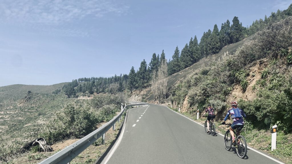
After about five kilometres we leave the asphalt and dive into a forest: the Pinos de Gáldar pine forest. The road there rises steeply almost immediately, but fortunately my chain 'saves' me when it comes off in last gear. That gives us time to gather our courage. Santiago updates us on the native flora and he shows us the plant species Tajinastes, Tabaias, Mirtillo, Retamas and Cobezos, among others. While Santiago then routinely reattaches my chain, Kim climbs up ahead. I follow shortly after on the one-light resistance.
Further up
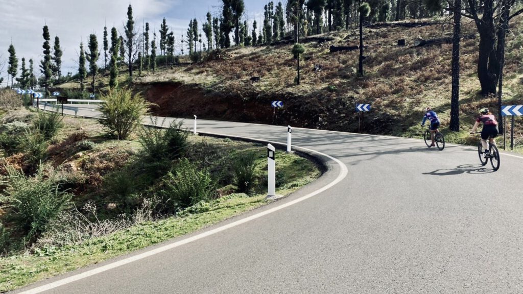
Surely this is the very best kind of cycling in Gran Canaria as far as I'm concerned: climbing on forest trails and hurtling up the rocks, surrounded by tall pine trees. Out of breath, but with the focus so necessary on unpaved trails. At the top of the short climb, Kim awaits me smiling, thinking we are only halfway up. But it turns out we are already allowed to descend from here. Through the 'pine forest' follows a beautiful long rolling descent. The first sections are a bit steeper, but doable even for us amateurs. We bounce over the rocks with concentration and practise our 'piano fingers'. According to Santiago, this is the way to descend without cramp in your hands. He also teaches us that, against our intuition, it is better to descend a bit faster, because that is actually easier than slowly and carefully.
Read also:
A short climb for the view
After part 1 of the descent, Santiago squeezes the brakes, gets off his bike and puts it against a rock. Here, on the other side of the cliff, there turns out to be a special cave: Cuevas de Caballero o de Las Machas. 'Macha' means 'woman who looks like a man'.
Following him
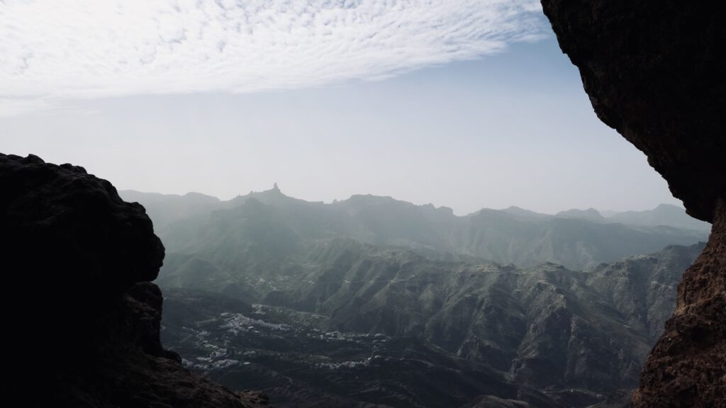
Kim fearlessly climbs around the corner behind Santiago, but my wind trauma holds me back for a while. I swallow a few times: I won't let this stupid fear make me miss out on this experience. Foot by foot I shuffle around the corner, as close to the rocks as possible. The wind whistles around my ears. Once on the other side, we have a brilliant view of the mountains and the valley. Santiago shows us the cave, where we even discern some ancient wall paintings. We clamber further over the rocks and take in the shimmering panorama of Caldera of Tejeda. Gran Canaria is fantastic.
No tea party
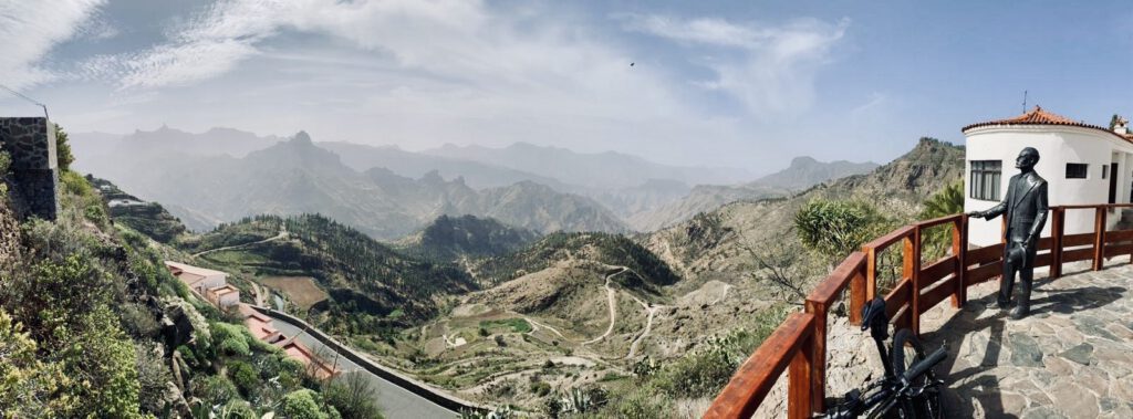
Then Santiago gets impatient. We can almost hear him thinking: 'this is a bike ride ladies, not a tea party!' Meanwhile, we climb back to our bikes and start the second part of the descent. Like accomplished descenders, we fly "piano fingers, piano fingers!" between the trees until we reach an asphalt road again. Then it is only a few kilometres until we cycle into the beautiful village of Artenara. Artenara is the highest village in Gran Canaria, at 1270 metres above sea level. We are welcomed by a statue of Christ with spread arms. Once in the village, we also find a more modern statue of a bicycle, which we of course take a photo with. Santiago also takes us to the Unamuno viewpoint, with spectacular vistas.
Miquel de Unamuno
Miquel de Unamuno was a famous writer and philosopher who stayed on the island in 1910 and described the rugged terrain with the words 'petrified storm'. There is also a fantastically beautiful mtb trail in the depths. This beautiful village is a good place for a stopover, and in the little cafe Arte-Gaia Restaurante BioTasca we must taste Santagia café con leche and churros. The coffee comes in large mugs, and the owner decisively shows us how to dip the churros in the coffee afterwards.
Back home
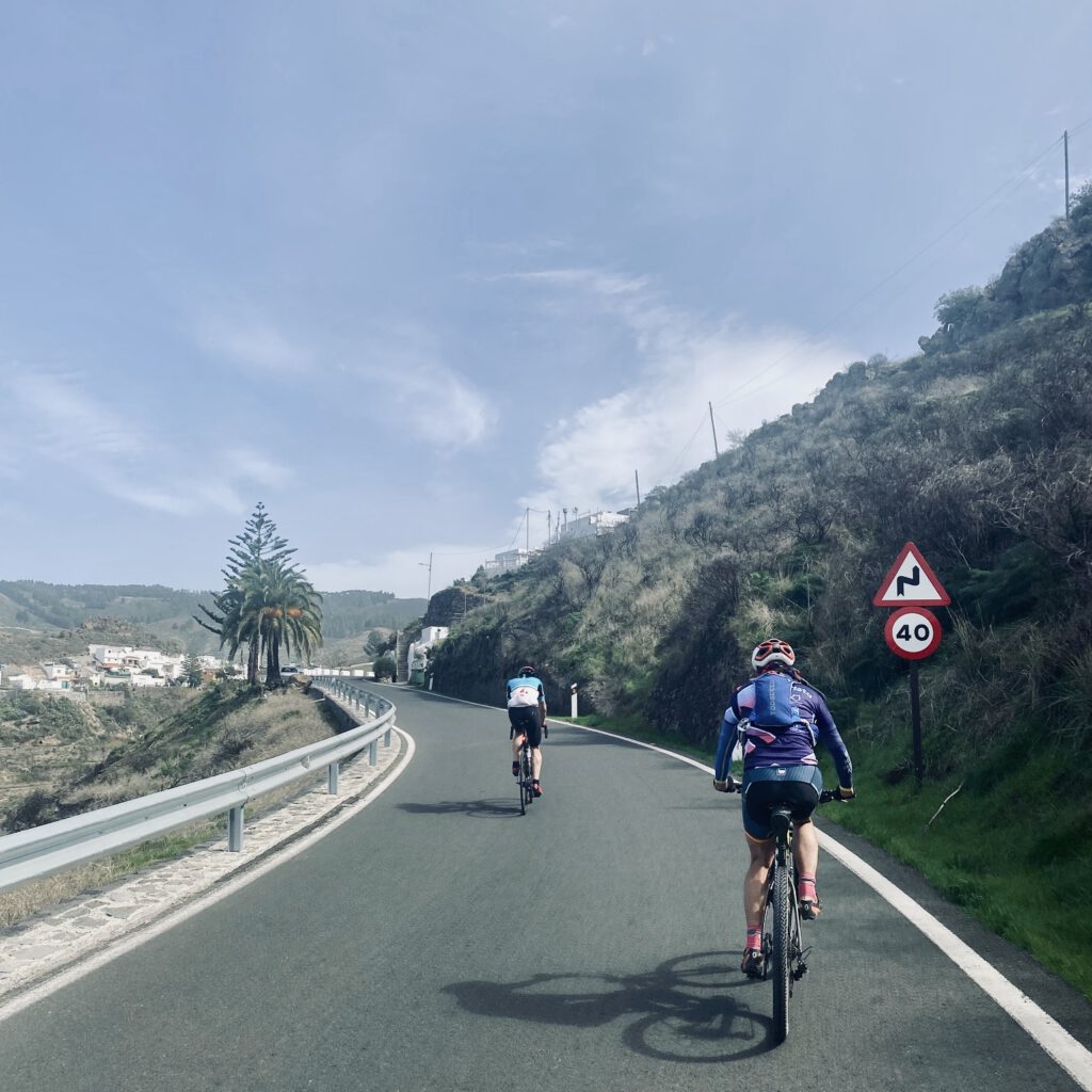
We also secretly eat a banana and prepare for the return journey. Now comes the trickiest part of the route, with the most climbing kilometres. But fortunately, the gradient does not exceed 9% anywhere. That should be doable. Before we start the return journey, we take a quick look at a restaurant that also seems to be carved into the rock face. Wherever you look here, the view is breathtaking.
One last look back, then we get back on for the final kilometres. In Santiago's wheel. We both find our own cadence. Over the GC-21 we meander back uphill. After the steepest kilometres, Santiago steers his bike into the shoulder at about 1,500 metres. He lets the small black pebbles slide through his hands: 'this we call Picón, they are volcanic ashes!' Picón is one of the many words in the Canary Islands that have their origins in the volcanic nature of this archipelago. A natural spring appears to seep out of the rocks. We make a bowl of our hands and drink the fresh mountain water.
Route
Final Stretch
Refreshed and refreshed, we fill our water bottles and start the final stretch. We stop one more time at Mirador de Pinos de Caldar, from where there is a great view of crater of an extinct volcano. And then it really is time for the final kilometres. Just before we reach the super steep driveway to the house, Santiago warns us: 'Lightest gear!' Kim dances uphill on the pedals but I choke on this last bit. With bike in hand, I complete the last few metres to the gate. There Santiago stands ready with freshly picked daffodils. We feel like real stage winners. Only the rondemisters are still missing. What a wonderful ride and how much we enjoyed it. With a big grin, we get into the van for the journey back to Maspalomas. We look at each other: 'A rest day tomorrow?' Yep, a rest day tomorrow!
Day 5 - How a day of rest did not become a day of rest after all
Although we had thought yesterday that we would schedule a rest day today, the beautiful mountains in central Gran Canaria have captured our hearts. We want to go back, we decide, and then we'll make it a 'cycling rest day' and put on our hiking boots. At the car rental in Dunas (Lucas Rent a Car), we rent the very last car available that day: a Mini Cooper Cabrio. Kim climbs behind the wheel, Tim plops down next to her and I sit in the back. We put on our sunglasses and drive off. We feel like real movie stars as we cruise through Maspalomas with the roof open. Movie stars in a film about mountain hikers, that is. Santiago gave us some tips for great hiking routes yesterday. We drive north via the GC-60 to Llanos de La Pez, a recreational area with picnic areas, plenty of parking and the starting point of some nice hiking trails.
Start of route
Here we start the first part of our walking route, which takes us to the famous Pico de las Nieves. This is the second-highest mountain on Gran Canaria at 1949 metres. Through a forest of pine trees we follow the steep footpaths up, Kim with professional hiking gear including walking sticks and Tim using a broken-off branch as a walking stick. Around us, we see that the underside of many tree trunks is blackened. There were forest fires here some time ago. Fortunately, the Pinus canariensis, or Canary pine, one of the trees that is the most resistant to forest fires of all.
Rocks up
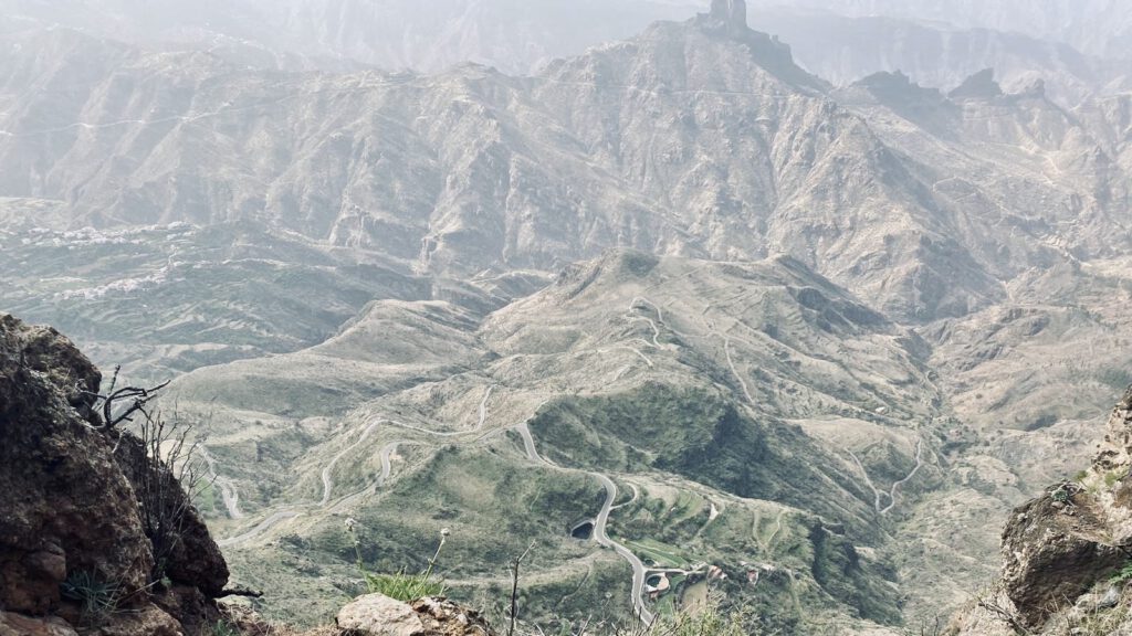
As we near the Pico the landscape changes, we clamber up the last stretch over rocky ground. At the top, we climb onto a viewing platform to feel 'king of the world' for a moment. Then we treat ourselves to coffee, cola and fresh tangerines from the food truck parked in the car park near the summit. We see several cyclists cycling up to that summit, taking the usual 'mountaintop selfies', only to turn around again. Normally you can also see Tenerife's Teide again from this point, but it's a cloudy and windy day, so today it remains just veiled mountain peaks. Fortunately, those vistas are also very nice and we do get to see the Roque Nublo (rock in the clouds) monolith, a characteristic large rock formation and the third highest point on the island.
Stopover
After our stopover, we descend in the same direction, only to continue hiking towards Degollada de los Hornos and El Montañón. We hike along a narrow ridge, climbing up a rocky slope by hands and feet, passing Gran Canaria's most famous peaks: the Roque Nublo, El Fraile (a rock that looks like a monk) and La Rana (the rock next to it that looks like a frog).
The last stretch of the route runs along the Presas de los Hornos reservoir. It is a beautiful walking route, sometimes requiring real clambering over rocks. The views are breathtaking, the descents on loose gravel sometimes treacherous, and our calves seem to get stronger with every step. After more than 11 kilometres and over 500 altimetres of hiking through the mountains, we arrive back at the starting point. We sink down on the car seats of our Mini Cooper and look at each other with big, tired smiles. This may not have been a rest day, but it was a damn fine one.
Rest day - hiking day
When cycling in Gran Canaria, we really recommend leaving your bike for one day and putting on your hiking boots. That way you'll get to places you won't even get to on a mountain bike, and also experience Gran Canaria's fantastic mountains in a different way. But tomorrow we'll take the bike again. Tim will explore the centre of the island from Maspalomas tomorrow, planning a ride of more than 100 kilometres. We are going for the more manageable version and pondering ways to get ourselves and our bikes into Ayacata. According to Santiago, Ayacata is a perfect starting point for a nice route with quite a few altimeters in the beautiful centre of the island. But first: eat, drink and sleep.