
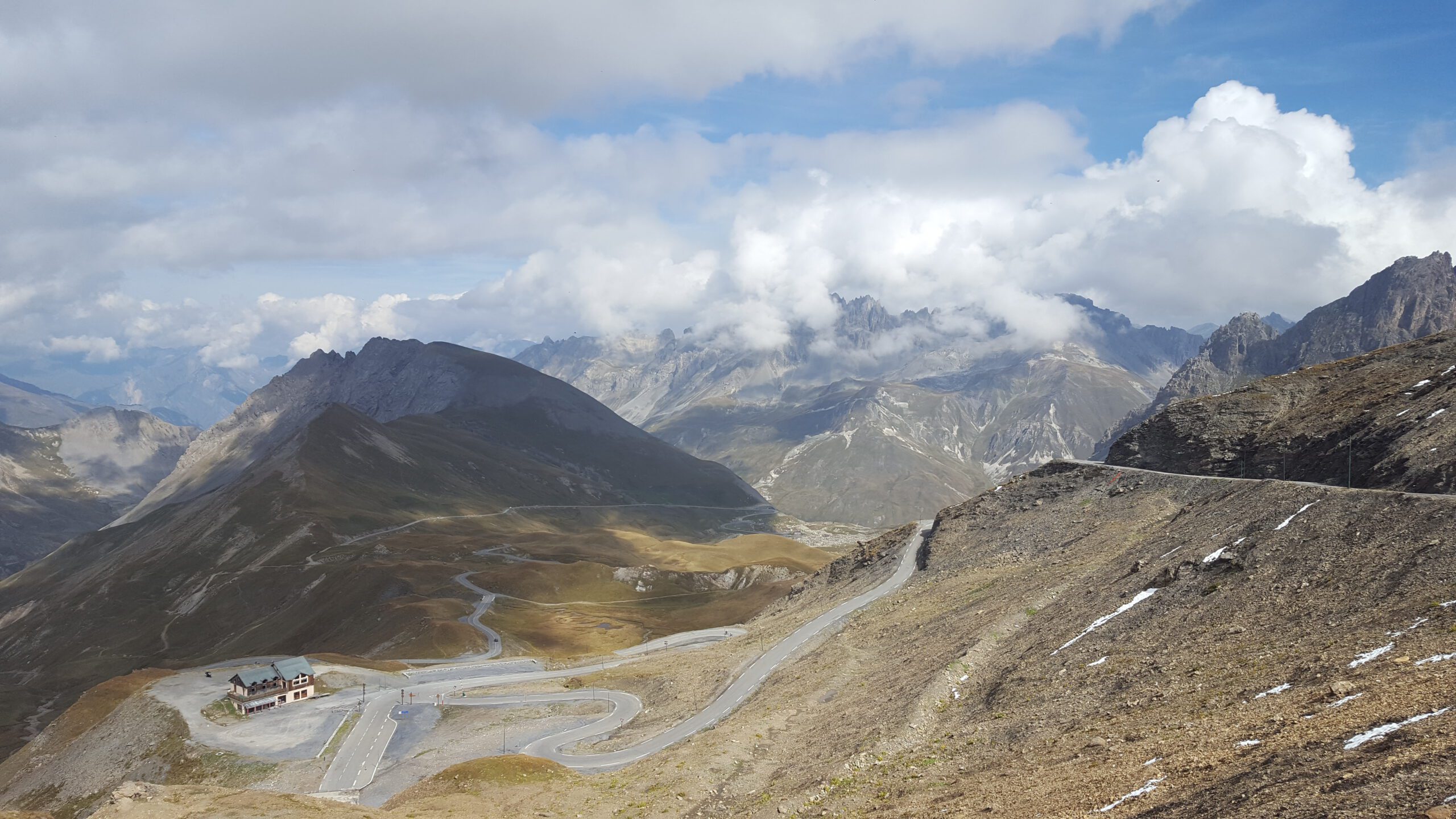
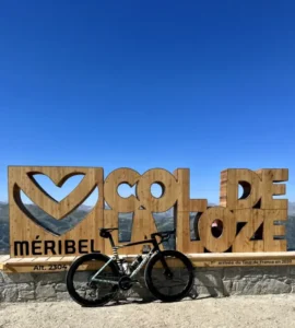
In our Classic Rides section, we take a look at the well-known classic routes and climbs. Our guest bloggers Erwin and Erwin, known from the Mountain High Chasers, Here are the most beautiful cycling destinations for us. The result: plenty of inspiration for you to plan your next cycling holiday. This time Erwin (without Erwin) was in France. Anyone who wants to cycle in France can't miss the Alps Onwards. One of the most famous, but also notorious climbs is that of the Col du Galibier. The tour used to go over the mountain quite often, but rarely as a destination. With a summit at 2640 meters, that’s not nothing. Back to the present. Because you know what makes this report extra beautiful? Erwin was on this mythical col… in the snow! And those are some beautiful pictures! Are you joining us for our Classic Ride: Col du Galibier?
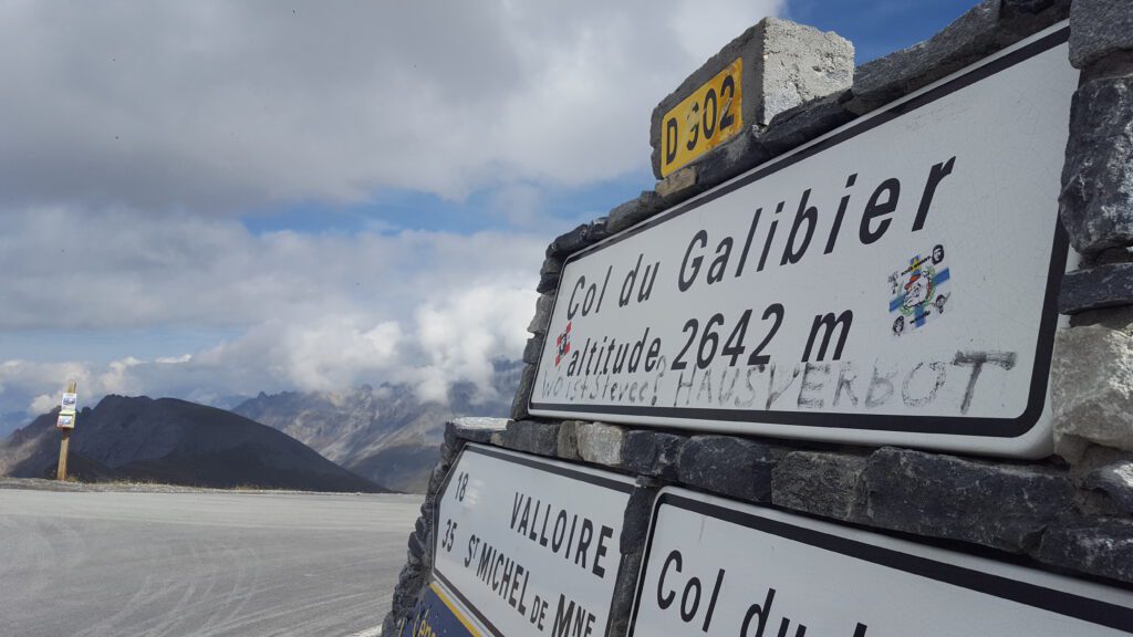
The Col du Galibier at a glance
- Summit: 2,642 metres, one of the highest passes in the Tour de France.
- From the north: first the Col du Télégraphe from Saint-Michel-de-Maurienne (11.8 km at 7.3%), then via Valloire to the summit. Around 35 kilometres of climbing in total.
- From the south: from Briançon over the Col du Lautaret (27.8 km at 3.8%), then the short, steep finale to the summit.
- Open: usually from June to October. Check beforehand whether the pass is open.
Updated in October 2026 with the key facts and practical tips. The story below is our original article.
Heart of winter
It’s not even a day old yet and I’m lucky enough to be on my way to becoming a real alpine giant. Now I must say right away that it’s impossible to reach the top by bike or car at this time of year, but to be here again is fantastic. It’s the heart of winter and the slopes are covered in snow, allowing the surrounding area to show its true beauty. As we climb up, this time in the car, the memories of five years ago come flooding back, as if it were yesterday and again it’s fantastic.


Hidden behind ‘collen’
At 2642m, it is indeed fitting to call it a giant; nevertheless, the Galibier manages to hide well behind other ascents. You can reach the summit from two sides, but from both sides you must first overcome a different col before you are allowed to begin the Galibier itself. This fact, in itself, can be approached from two sides. You think, bonus! I get to climb two cols for the price of one; or you can take a good look at them to see if you can perhaps overcome the little brothers of the Galibier in a different way.


Col du Lautaret
The long-distance cousin of the Galibier is the Lautaret. From the well-known town of Briançon, you can start a ride of just 27.8 kilometers. That sounds more strenuous than it actually is, because the road gradually rises up to the top. With an average of 3.8%, it’s a good warm-up, although… you’re actually warming up for 27.8 kilometers. Something to keep in mind, especially if you’re going to visit the big farmer after the long-distance cousin. From the top of the Col du Lautaret, you take the D902 towards the top of the Galibier. As I wrote earlier, the top in winter is not accessible; in fact, it is advisable to check with the local authorities to see if the top is open. Between June and October, you can be fairly sure that the top is open; however, if you are considering trying it earlier in the spring, please ask.
Col du Télégraphe
It’s a fun topic for discussion, but if you ask us, you’ll have the ‘real’ Galibier experience when you start from Saint Michel de Maurienne. A very ordinary French village at the foot of the climb. In the middle of the village you take the D902 over a bridge that also immediately announces the start of a tough climb. With a length of 11.8 kilometers and an average elevation gain of 7.3%, you can call this a serious climb.
We start this climb with the idea that we ‘have to’ reach the top of the Galibier in one go; that means a total of 35.3 kilometers of climbing, so we decide to start slowly. We might as well take it easy, but the mountain always has the final say. The first part is the hardest, and after a while, swinging between trees and houses, the climb flattens out a bit, which allows you to mentally prepare yourself for the big brother. In the final kilometer, we decide to throw in one last sprint for the mountain points on the top, something I later regretted….

The big brother
After the Télégraphe, you have more than two kilometers to rest your legs; you can actually descend a bit before starting the Galibier climb. The start of the climb is in the picturesque village of Valloire. Definitely worth visiting here to enjoy the French Alps atmosphere. A real must-see in both winter and summer!
We set ourselves the goal of climbing every hill without taking a step off the ground, so unfortunately we have to skip Valloire for now (we went back later for a delicious cup of coffee, a cola and a pasta) and drive through the village. At the end of Valloire there is a roundabout where it is clearly marked where the top is. At that moment you still have no idea, because even now he still manages to hide well. At this moment we are around 2000m and the trees have given way to meadows and immense rock formations. As you often see on cols of this size, you can see far ahead and see the road running up between the mountains. I see other Erwin driving in the distance and decide to drive at my own pace (that sprint from an hour ago…).

Best for last
Starting from Plan Lachat, a parking area from where many hikes also depart, the pure beauty begins. The road here does take a steeper climb, but the surroundings are truly breathtaking. We are even greeted by several marmots who cheerfully chirp to us. Instead of long straight stretches, the route now winds up gracefully towards the top. Here and there we still see some remnants of winter, but we enjoy the sun on our helmets. Once on the top, you can truly see how high you have reached. The views are phenomenal and you can see the road from where you came clearly. After these 35 kilometers, the big brother has saved the best for last!

A giant of a classic
The Col du Galibier is a true classic ride. This is not so much due to the cycling history that has been written here (the Tour He has only dared to climb it twice as far as the finish), but especially because of its size. With its height, the Galibier ranks among the top 10 highest passes in Europe. The fact that you have to (or can) climb another pass first makes it extremely difficult. For the enthusiast, of course, it is possible to do the first pass by car so that you can fully enjoy all the beauty that the Galibier has to offer.
Questions about the Galibier
Which side is the most beautiful?
The north side via the Télégraphe and Valloire gives the real Galibier experience, with the most beautiful part after Plan Lachat. The south side is easier and combines well with Alpe d’Huez or the Izoard.
Where is the best place to stay?
Valloire sits right between the Télégraphe and the Galibier. On the south side, Briançon and Bourg-d’Oisans are good bases.
More climbs, routes and hotels in the French Alps are on our destination page: French Alps.
The routes from this story
- Alpe d’Huez & Bourg-d’Oisans: Col du Galibier from Le Bourg-d’Oisans95.9 km · 2,765 hmGPX ↓
- The Col du Galibier from Valloire18.1 km · 1,238 hmGPX ↓
Questions & tips
Do you have any questions about this route, or have you been there yourself? Share them here. We read everything and usually respond within a few days.