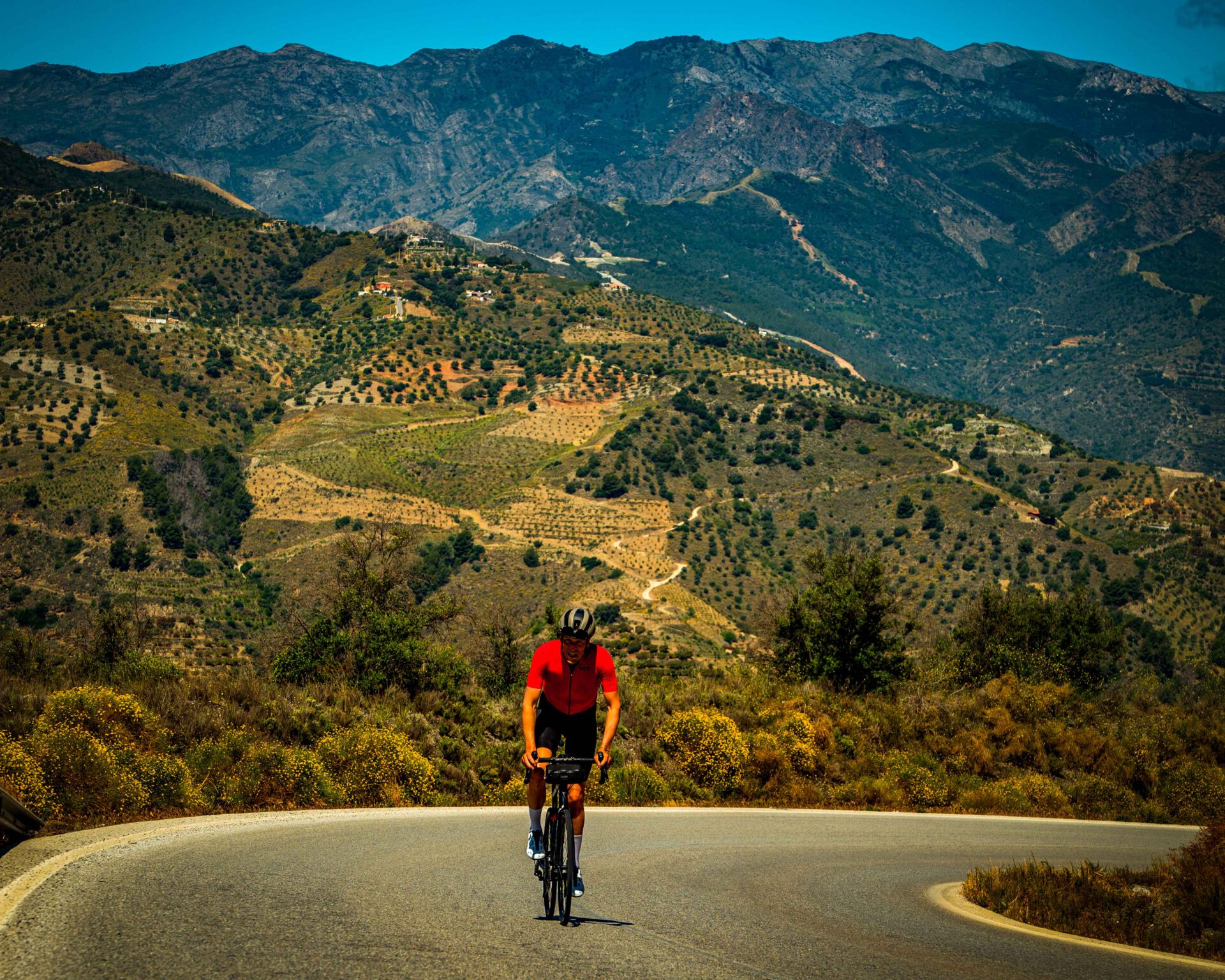
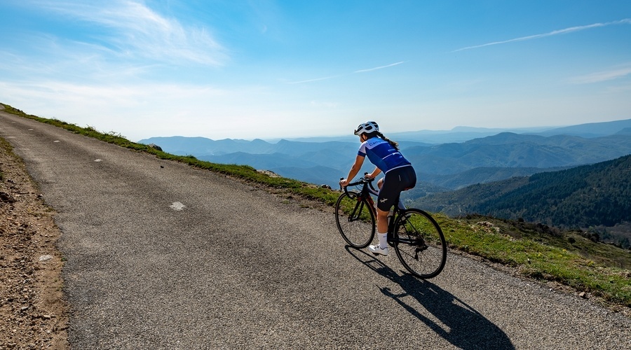
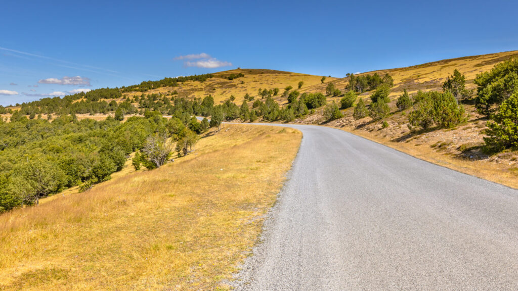
The Cévennes. The forgotten mountain region in the Central Massif. Where you meet more vultures than cars, where the roads are smooth as a billiard cloth and where the climbs are at least as tough as in the Alps. Only: without the traffic jam of motorhomes, motorbikes and loads of cycle tourists jostling each other for the best photo or trying to imitate the pros.
We get it. You think of cycling in France and your head goes to Alpe d'Huez, the Tourmalet, perhaps the Ballon d'Alsace. Logical. But if you really want to climb this summer on deserted roads, with steep percentages and villages where time seems to stand still, you should head to the Cevennes. Located between Lozère and Gard, in the middle of the National Park (UNESCO World Heritage Site), there is a network of D-roads here that seems to have been built especially for cyclists. Spoiler: it is not, but it feels that way.
Why Cévennes and not the Alps or Pyrenees?
A fair comparison. The Alps are iconic, the Pyrenees epic. But the Cévennes has something those two no longer have: tranquillity. We have it briefly in
| Cevennes | Alps / Pyrenees | |
|---|---|---|
| Traffic | Virtually none. Secondary roads are extinct. | Crowded in summer, especially on well-known cols. |
| Road quality | Surprisingly good, even on the narrowest roads. | Varying, wear from heavy traffic. |
| Season | Lower altitude = cols open earlier, often as early as April. | High passes closed from October to June. |
| Character climbing | Steep, irregular, rhythm breakers. | Long, constant gradients. |
And then there's this: the Vosges and Jura are beautiful, but the climbs there remain more modest. In the Cévennes, you ride cols of 20+ kilometres with stretches of 15 to 20%. That's a different story.
The most beautiful climbs in Cevennes
For those who have ever read the book ‘The Runner‘ by Tim Krabbé, can totally empathise with the Cevennes region. The book is set there and with that book in mind, you can explore the region even better.
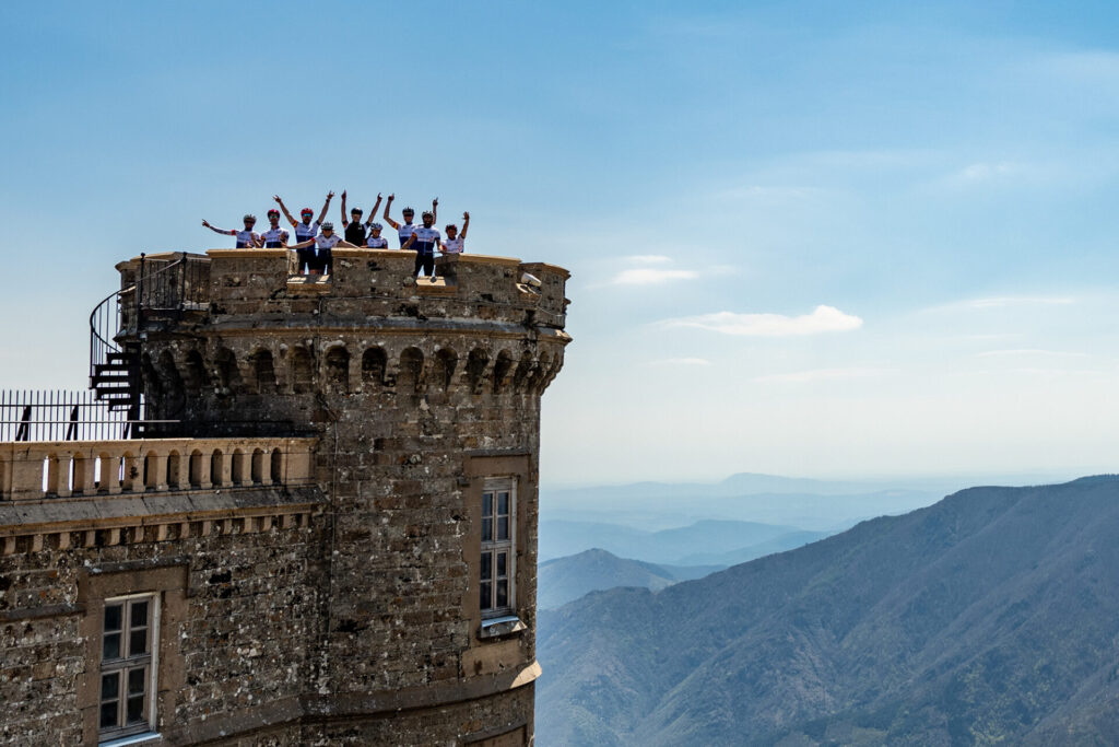
Mont Aigoual: the climb to cycle in the Cevennes
Mont Aigoual is a climb you can't ignore if you go cycling in the Cevennes. At 1,567 metres, it is, after Mont Lozère, the region's highest mountain and the highest point you can reach by bike. The road to the characteristic observatory at the top is literally and figuratively the highlight of the Cévennes. You won't get any higher here.
What makes Mont Aigoual unique is the number of ways you can climb it. As many as eight different routes lead to the summit: four via wider main roads and another four via smaller, quieter mountain roads. This makes Mont Aigoual not only one of the most famous climbs in the Cévennes, but also one of the most versatile. Each side has its own character, its own rhythm and its own views.
The ascent from Trèves, deep into the Gorges du Trévezel, captures the imagination. Immortalised in the work of Tim Krabbé, this side takes you from a rugged gorge slowly up towards the bare, open summit. The variant from Rousses is considered the toughest of them all, with steeper sections and a more irregular gradient that forces you to find your pace again and again.
It is precisely this variety that makes Mont Aigoual an essential climb for anyone serious about climbing climbing and cycling in the Cevennes. It is a mountain you climb not once, but several times, each time by a different route, each time with a different experience.
You can Mont Aigoual climb via at least eight routes. The most popular:
- From Meyrueis via Col de Perjuret: 26km, average 3.3%. False flat, false summits, and then suddenly that last wall to the observatory.
- From Valleraugue: 26.7km, average 4.5%. More regular, nice build-up.
Do you know The Runner by Tim Krabbé? This is the setting. It doesn't make the climb any easier, but it does make it more beautiful.
Mont Aigoual, Trèves, France
- Distance: 27.5 km, Elevation difference: 974 m, Average gradient: 3.5 %
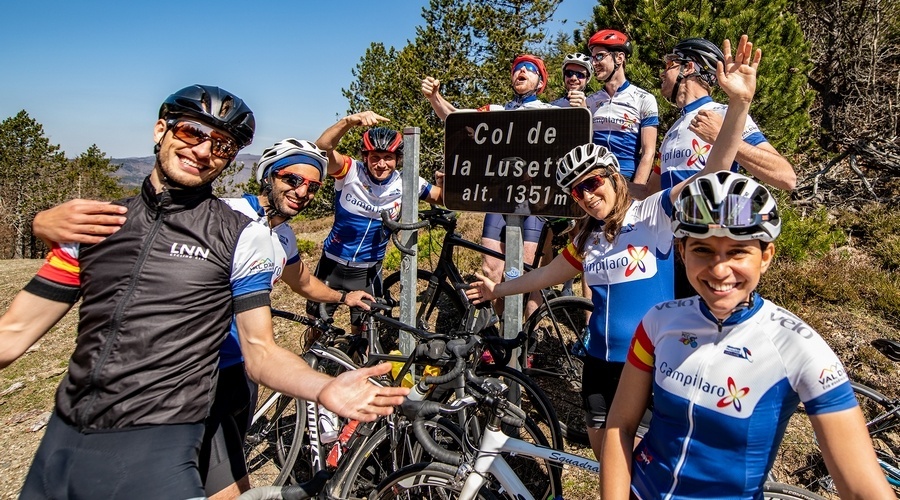
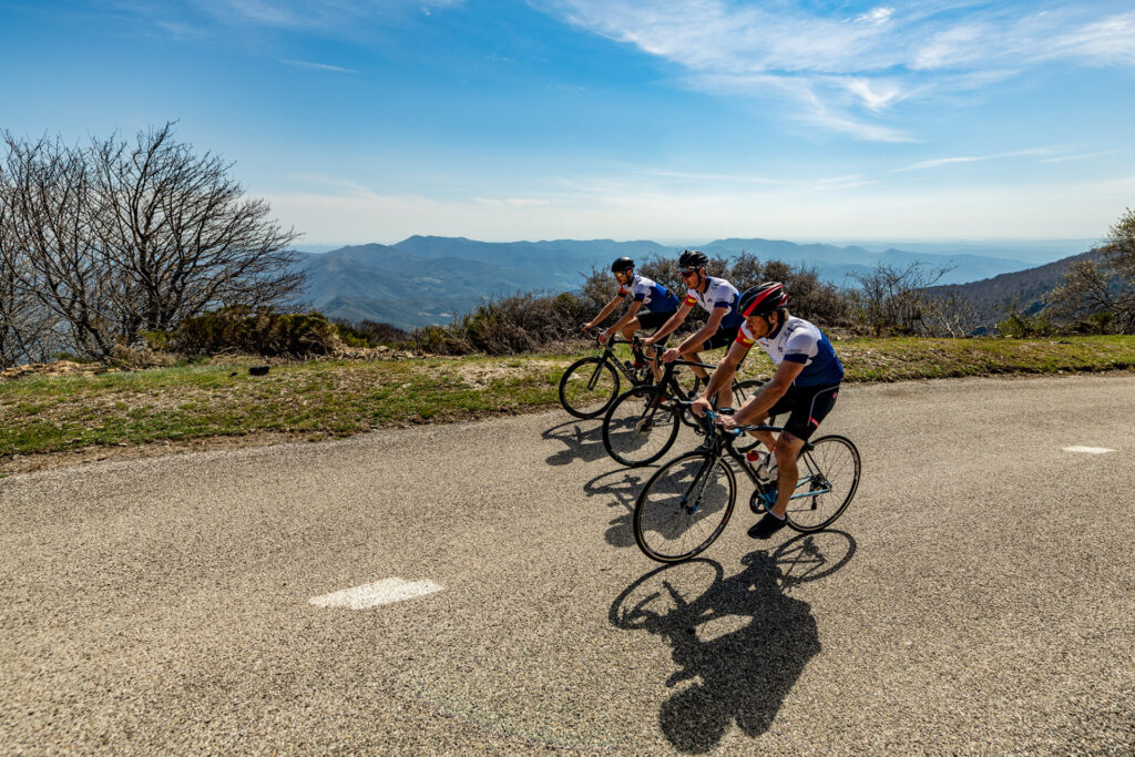
Col de la Lusette (1,351 m): the Cévennes' toughest climb
The Col de la Lusette is one of the most feared yet most impressive climbs for those going cycling in the Cevennes. On paper, this climb seems manageable: 18 kilometres long with an average gradient of 6.4%. But those who start here soon realise that this average says little. The Col de la Lusette is not a tasty runner. It is continuous shifting gears.
The middle section of the climb, between kilometres 11 and 16, is particularly notorious. Here the gradients structurally rise above 11%, with peaks of up to 20%. These are not short pinpricks, but serious stretches that keep going. A light gear is not a luxury here, but a requirement. It is precisely this unpredictable character that makes the Lusette one of the toughest climbs in the Cévennes.
The climb takes you through dense forest, along narrow roads that seem specially built for cyclists. The silence is complete. No traffic, no distractions. Just you, your breathing and the road slowly folding upwards. As you climb higher, the landscape opens up and the summit becomes palpable, even before you see it.
The descent also requires full attention. The tarmac is rough and technical in places, with bends that can be sharp and irregular. Especially in wet weather, caution is required. The Col de la Lusette is often compared to the Mont Ventoux for good reason, not because of its height, but because of the intensity and character of the effort.
For those who really want to experience the Cevennes, this climb is part of it.
Corniche des Cévennes (1,026 m): the most beautiful climbing route for cycling in the Cévennes
The Corniche des Cévennes is not a classic climb, but a route that brings together everything that cycling in the Cevennes so special. Not an endless, straight climb, but a succession of ascents and descents over a ridge, with constantly changing views and a rhythm that never becomes completely steady.
The ascent starts in Saint-Jean-du-Gard, a typical Cévennes village where the road starts climbing almost immediately. The first serious passage leads to the Col de Saint-Pierre at an altitude of 597 metres. The tarmac is excellent and the road winds up in long, flowing curves through forest and along open slopes. It is a climb that invites you to find your own pace, without ever becoming extreme.
From there, the road continues uphill towards the Col de l'Exil at 704 metres. The gradients remain friendly, but the profile remains treacherous. Because just when you think the hardest is behind you, a descent follows, which immediately turns into a new climb. This is the character of the Corniche des Cévennes: a constant alternation of effort and recovery.
After Le Pompidou, the final section begins, towards the Col des Solpérière and ultimately the Col des Faïsses, the highest point of this route at 1,026 metres. It is mid-mountain with good reason, with peaks that don't measure up to Alpine violence, but in the Cevennes it feels different. What sets this route apart from other climbs in the Cevennes is its location on the ridge. For kilometres you cycle along the edge of the massif, overlooking deep valleys and endless ridges. A climb that is all about rhythm, views and the feeling that you are really on the move.
For those visiting the Cevennes, the Corniche des Cévennes is a must-do route. Not because it is the toughest, but because it perhaps best shows why cycling in the Cevennes is so special.
Sommet de Finiels (1,699 m): on paper the highest point in the Cevennes
The Sommet de Finiels is the absolute roof of the Cevennes. At 1,699 metres, it is the highest point you can reach by bike in this rugged massif. For that, you will have to go off-road. Because the highest path you can cycle by road bike only goes up to 1543m. For those who really want to experience what cycling in the Cevennes means, this climb undoubtedly belongs on the list.
The climb connects Le Pont-de-Montvert with Le Bleymard and runs along the flanks of Mont Lozère, the region's highest mountain. From the first kilometres you climb gradually, under a canopy of plane and other trees that provide shelter from the sun. The gradients remain relatively constant, so you quickly get into a steady rhythm. It is not a climb to be conquered with brute force, but one that you conquer with patience and regularity.
What immediately stands out is the tranquillity. Through traffic almost always chooses other routes, so you often cycle alone here. Just the sound of your tyres on the asphalt and the wind picking through the grass and trees. This is one of the purest climbs in the Cevennes: quiet, secluded and completely at the cyclist's pace.
As you get higher, the landscape changes. The trees disappear and give way to open plateaus. Here, above the tree line, a vast panorama unfolds. To the west lies the Sommet de Finiels itself, with its bare summit at 1,699 metres. On the eastern side, you can see Mont Lozère, which is just a little lower at 1,674 metres, but looks at least as impressive.
The Sommet de Finiels is not only special geographically, but also hydrologically. Here lies the watershed between two of Europe's great river basins. Rain falling on its northern flank flows via the Rhone to the Mediterranean. Water on the southern side finds its way to the Atlantic via the Tarn and Garonne rivers. Cycling along this ridge, you literally move between two worlds.
Col du Pré de la Dame - one of the toughest with views of the Ventoux
The Col du Pré de la Dame is one of the most beautiful and underrated climbs of the Cévennes. From Génolhac, you climb 15 kilometres at an average of 6.4%, with long, regular stretches.
The other side is shorter but steeper. Above, the landscape opens up and, on a clear day, you can even see Mont Ventoux in the distance.
It is a climb with no course history, no crowds, but with everything that cycling in the Cevennes makes it so special: tranquillity, nature and endless roads uphill.
Col de Perjuret (1,031 m): the gateway between the gorges and the peaks of the Cévennes
The Col de Perjuret feels a bit like a transition. Not only in altitude, but also in landscape. This pass forms the natural link between the deep gorges of the Gorges de la Jonte and the higher, open peaks of the Cévennes massif. For those going cycling in the Cevennes, this is a climb that literally takes you from one world to another.
The ascent begins in a rugged setting of cliff walls and narrow valleys. The road cuts through the rock, snaking past rock formations and gradually climbing away from the gorge. The tarmac is narrow and quiet, with hardly any traffic. Here you cycle in complete silence, surrounded by nature.
What makes the Col de Perjuret special is the feeling of escape. Below you are the deep gorges, above you the landscape opens up towards the higher plateaus of the Cevennes. The vegetation changes, the view widens and the air feels cooler. The climb itself is not extremely steep, but it is one with ‘character’. This is one of those typical climbs in the Cevennes where it's all about the stunning surroundings
Choosing Basecamp - where do you ideally start your adventure?
At CyclingDestination, we like to work with Basecamps, places that are strategically located in relation to the surroundings.
Florac
Headquarters of the National Park, located at the crossroads of the Tarn, Tarnon and Mimente rivers. From here you can drive ‘out’ of traffic within five minutes.
- Grand Hôtel du Parc: Accueil Vélo-certified, enclosed bike garage with charging points, swimming pool, large garden. In the same family since 1903.
- Le Rochefort: Logis de France, just outside the village, 24 rooms, easy access to the Gorges du Tarn.
Meyrueis - the picture
Stone bridges, a bell tower, and the perfect base for Mont Aigoual and the Gorges de la Jonte. The village has several terraces.
Logis Hotel - nice and clear
Sainte-Énimie - for direct access to Gorges du Tarn
Nestled in the Gorges du Tarn, one of France's most beautiful villages is an ideal base
- Château de la Caze: 15th-century castle hotel, 4 stars, private beach on the Tarn, ideal for a nice swim after a tour of the area.
- Logis Hôtel Auberge de la Cascade: Sober option, secure bike storage, and an owner who can tell you exactly which route to ride.
In search of chestnuts, trout and a burger at the summit
Cévennes culinary is all about the châtaignier, the sweet chestnut. For centuries the staple food here, now incorporated into bread, flour and desserts. Also: fresh trout from the rivers and Aubrac lamb of the causses.
At the top of Mont Aigoual sits a snack bar where you can grab a burger and a beer. Soon the question falls, “Can we sit inside?” The wind at 1,567 metres can be strong.
In villages like Vebron and Meyrueis you'll find boulangeries for a croissant halfway through. Not everywhere, and not always open. Plan your stops.
Practical - what you need to know
- Water: villages are further apart than you think. Always take an extra water bottle with you.
- Weather: warm in the valley, cold and windy at the summit. Always have a mackintosh or windstopper in your back pocket.
- Navigation: signs are scarce on the smaller roads. GPS is essential. The turnoff to the Lusette from Le Vigan is easy to drive past.
- Best period: June to September. October brings beautiful autumn colours, but also chances of heavy rainfall (the infamous épisodes cévenols).
- Descend: the Lusette downhill is technical. Varying road surface, sharp turns, steep. Take your time.
Bike rental
Don't have your own bike? Or don't have space to bring your bike? Then hire one! You can get a beautiful road bike or MTB through Cigale Aventure. They also have guided Tours. What more could you want?
For more info and bookings, check out their website: Cigale Aventure
Do you have any Cévennes climbs we should include? Or a bakery that does open early? We'd love to hear about it!